GO! View Basket

Search the entire catalogue by entering a key search term in the ‘search’ box or browse our stock by selecting from the list of categories below.

MAPS WORLD


Antique World Map by Blaeu (92066)
VIEW ITEM / MORE INFO
Cartographer : Joan Blaeu
Title : Nova Totius Terrarum Orbis Geographica ac Hydrographica Tabula
Date : 1637
Size : 25in x 20 1/2in (620mm x 520mm)
Description :

This magnificent beautifully hand coloured  original antique World Map - possibly the most famous and recognised of all antique World Maps - was published by Joan Blaeu in 1637.
This map was was published in various Atlases and as a single map by Willem Blaeu & the Blaeu family from 1606 until it was superseded by Blaeu's Twin Hemisphere in 1662.
During its 56 year life the map went through four different changes, editions or states. States 1-3 are rare, this map, the 4th edition, was published in the 1637 German edition of Joan Blaeu's Atlas Nouvs.
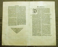
This map is in fine condition with beautiful original hand colouring, heavy clean stable paper and original margins.
(There have been 42 recorded sales of this map since 1983 with the top price of $25,000 recorded in 2006)

Background. This beautiful World Map is one of the most famous landmarks of the 17th cartography. Engraved and signed by Joshua van den Ende, it first appeared as a separate publication in 1606. In 1630 it was incorporated into Blaeu's "Atlantis Appendix" and then into the "Atlas Novus" in all subsequent editions until 1658. Its influence was enormous, and it was closely copied by some of the greatest Dutch cartographers, such as Pieter Van der Keere and Jansson. Others, such as Hondius, were forced to produce their own highly decorative maps to compete.
Geographically, the map was a reduction of Blaeu's large map of the world published in 1605. The charming cartouche in the interior of North America mentions its discovery by Columbus in 1492 and being named after Amerigo Vespucci in 1499. There is some confusion in the depiction of the landmass of the East coast of the United States, probably as a result of Indian reports of large bodies of water inland, almost certainly the Great Lakes. California is correctly shown as a peninsula. The Le Maire straits, separating Tierra del Fuego from South America, copied from an earlier map by Hondius, are clearly shown. In the north, a note beside "Nova Zembla" in the Arctic declares that it was reached by Willem Barents in 1596. In the Far East Korea is shown as an island and northern Australia is shown without any place-names.
Decoratively the most striking features of this map are the magnificent and innovative panelled borders. The upper border shows allegorical figures of the sun and moon and the five known planets; Mercury, Venus, Mars, Jupiter and Saturn. Along the bottom border are depictions of the seven wonders of the ancient world; the hanging Gardens of Babylon, the Colossus at Rhodes, the Pyramids, the Mausoleum of Hallicarnansus, the Temple of Diana, the Statue of Jupiter and the Lighthouse at Alexandria. Running down the left hand side of the map are representations of the four elements (Fire, Air, Water and Earth) and on the right, the Four Seasons.
(Ref: Shirley; Koeman; M&B)

General Description:
Paper thickness and quality: - Heavy and stable
Paper color: - off white
Age of map color: - Original
Colors used: - Yellow, pink, red, blue, green
General color appearance: - Authentic
Paper size: - 25in x 20 1/2in (620mm x 520mm)
Plate size: - 21 1/2in x 16 1/2in (545mm x 420mm)
Margins: - Min 1in (25mm)

Imperfections:
Margins: - None
Plate area: - None
Verso: - None

To discuss please contact me:
simon@classicalimages.com
61 (0)409 551910


Web Counter
Web Counter

Condition : (A+) Fine Condition

Price :

Ref. No. :

US$17,500.00 SOLD

92066

payment
shipping
ask a question