Search the entire catalogue by entering a key search term in the ‘search’ box or browse our stock by selecting from the list of categories below.
MAPS AMERICA
![]()
CANADA
![]()
|
|||||||||||||
|
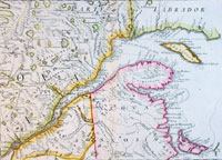
Cartographer : | Antonio Zatta | |||||||||||
| Title : | Paertie Orientale Del Canada, Nuova Scozia.. | ||||||||||||
| Date : | 1778 | ||||||||||||
| Size : | 21in x 15 1/2in (535mm x 395mm) | ||||||||||||
| Description : |
This map of the St
Lawrence River inlet, Nova Scotia and eastern Canada was published by Antonio
Zatta (fl. 1775-97) in his Atlas Atlante Novissimo. General Description: |
||||||||||||
| Condition : | (A+) Fine Condition | ||||||||||||
| Price :
Ref. No. : |
|||||||||||||
|
|||||||||||||