Search the entire catalogue by entering a key search term in the ‘search’ box or browse our stock by selecting from the list of categories below.
MAPS BRITISH ISLES
![]()
![]()
|
|||||||||||||
|
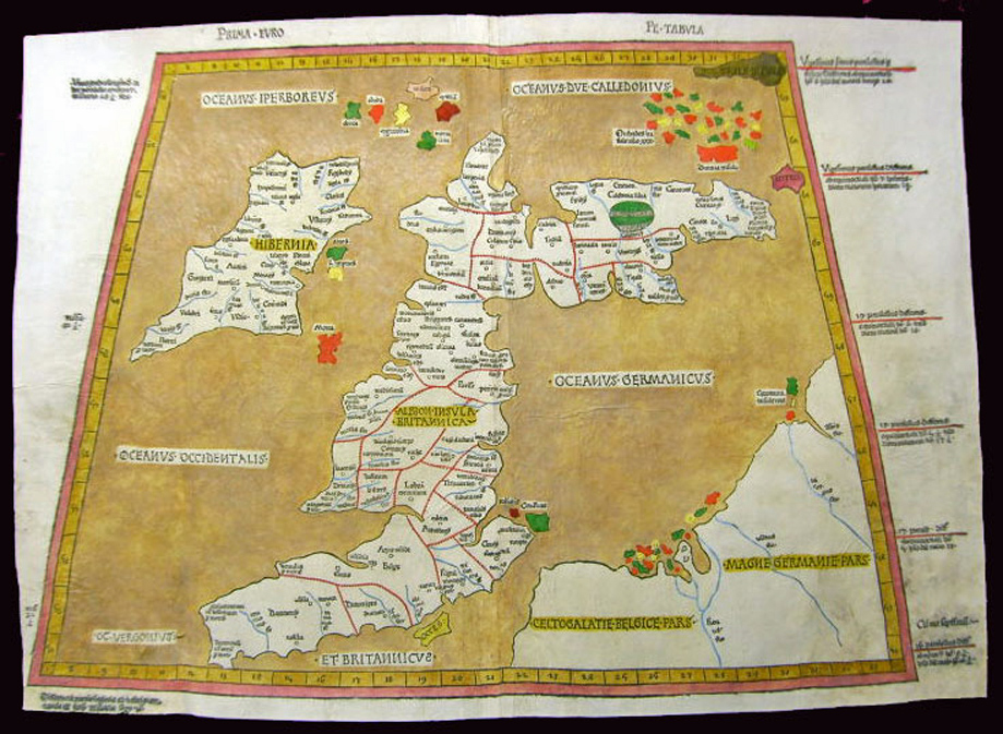
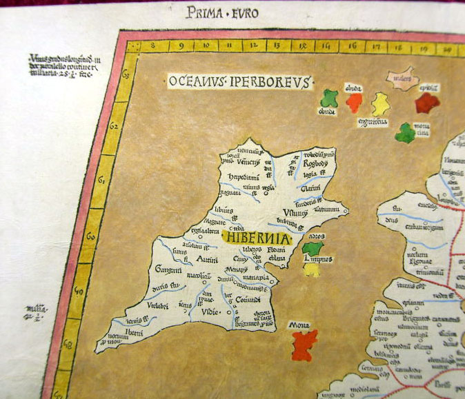
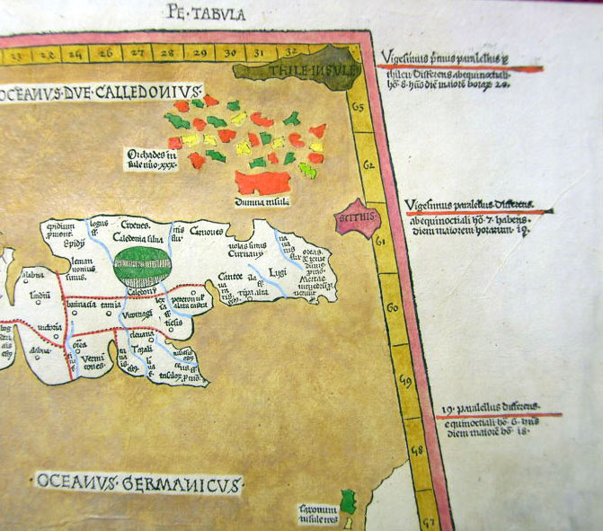
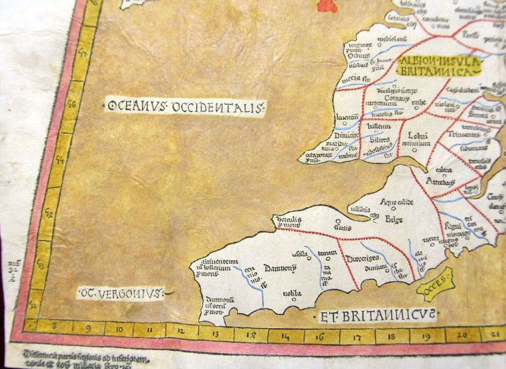
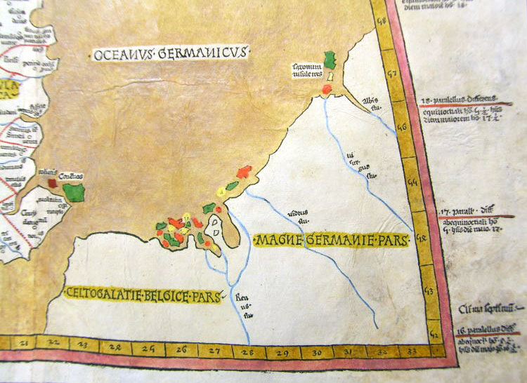
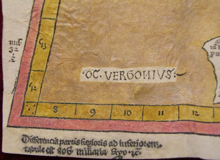
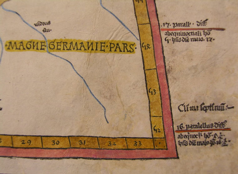
Cartographer : | Claude Ptolemy | |||||||||||
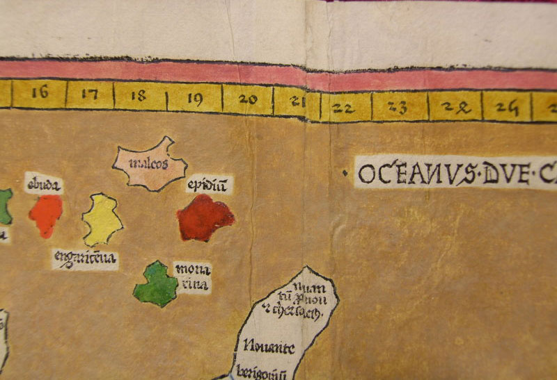
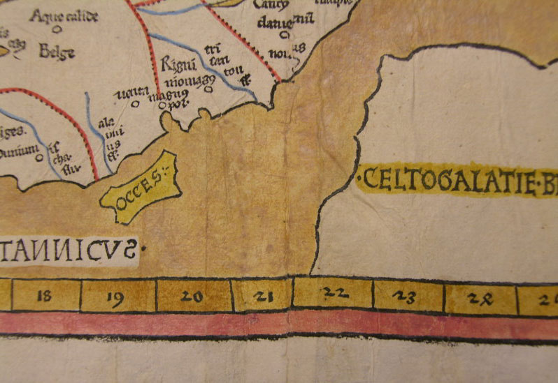
| Title : | Prima Europe Tabula | ||||||||||||
| Date : | 1486 | ||||||||||||
| Size : | 20 1/2in x 15 1/2in (552mm x 397mm) | ||||||||||||
| Description : |
This is a unique opportunity to acquire
one of the earliest published maps of Great Britain and
Ireland. A very rare map from an
atlases published only 47 years after Johannes Gutenberg
invention of the moveable type printing press in 1439.
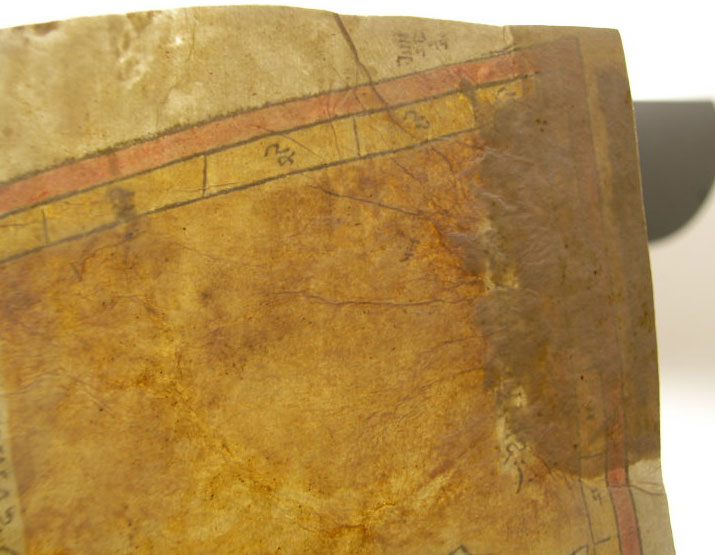
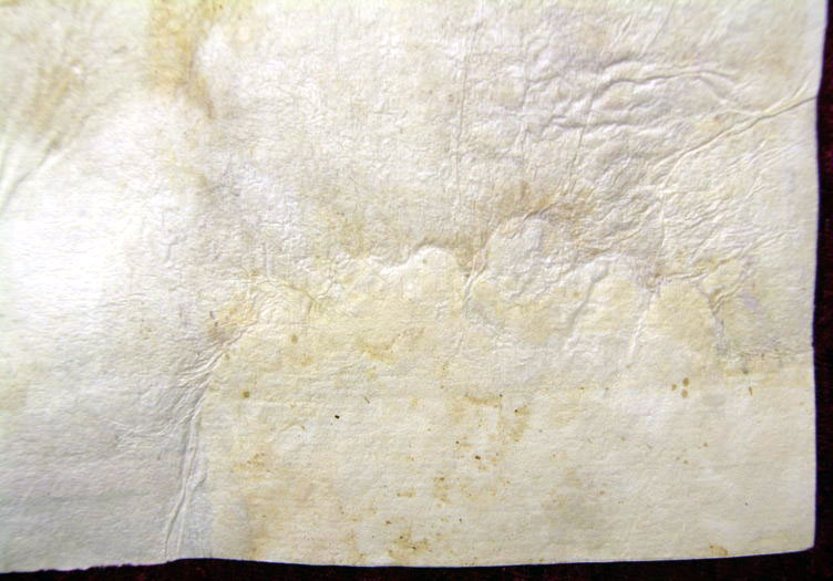
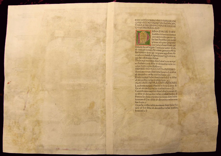
This large map is in fine condition on
strong sturdy paper, the printing impression is heavy
and clear. The colour is original and beautifully
applied. There has been professional restoration to the
L&R bottom corners. No loss of original paper and
restrengthened on the verso. The centerfold has been
re-strengthened, on the verso, with some light creasing
and rippling. Please see the images below. A great map
and a unique addition to any collection. The first edition's of Ptolemys Geographia was published in Italy in 1477, republished in 1478 & 1482. The next atlas to be published was north of the Alps by Lienhart Holle, in Ulm, Germany in 1482. Holles maps were printed from woodcuts, and are distinct with their heavy wash colouring for the sea areas, typically a rich blue for the 1482 edition, and an ochre for the 1486 edition. These bright colours, and the greater sense of age that woodcuts convey, make this series of maps one of the most visually attractive. Claude Ptolemy; The earliest printed atlases were editions of the geographical text of Claudius Ptolemy (or Ptolemaeus), a Greek astronomer and geographer working in Alexandria, circa 150 A.D. Such was the importance of Ptolemys work, and the wide influence it held over future geographers, that many of his errors were perpetuated by subsequent mapmakers. The most important of them was a miscalculation of the circumference of the earth. Ptolemy, himself, under-exaggerated the circumference if the earth, by calculating each degree of longitude as 500 stadia, instead of a more accurate 700 stadia. He then exaggerated the length of the Mediterranean by about 30%, and also that of Asia, thus greatly reducing the distance between the western tip of Spain, and the east coast of Asia. This had important consequences, for all future explorers including Columbus who was know to own the 1478 edition of Ptolemy Geographia. Re-discovery of the Ptolemy Texts: Following the fall of the Roman Empire, Ptolemys text was lost to western geographers. The earliest extant manuscript version of the Geographia is Arabic, and probably dates from the 12th Century. Subsequently, the text was translated into Greek, and circulated through the Greek World. In about 1400 a Greek manuscript came into the hands of the Byzantine scholar, Emanuel Chrysolaras, who was working in Italy. Chrysolaras undertook a translation of the text into Latin, and completed by his pupil Jacopo d'Angelo, in 1406. The Greek manuscript that Angelo translated was apparently lacking maps, but the data in the text contained the information to construct a set of maps, and numbers of scholars set about such work. Of them, the most influential, was Donnus Nicolaus Germanus, a German cartographer, active in Italy from the 1460s to 1480s. He was a prolific editor of the text and maps, and his work formed the basis for three of the four sets of Ptolemaic maps printed in the fifteenth Century, with the fourth, accompanying Berlinghieris Geographia, strongly influenced by him .
The first printed versions of Ptolemys Text: The
first published edition of the Geographia with maps,
which were probably engraved by Taddeo Crivelli, was
issued in Bologna in 1477. Conrad Sweynheym was also
working on an edition of Ptolemy in Rome in the same
period. After his death, Arnold Buckinck, saw the atlas
through the press, in 1478. Of the engraved editions of
Ptolemys Cosmographia the maps in the Rome edition
are the finest fifteenth century examples, and second
only to Mercators maps, from his 1578 edition. The
atlas proved popular, and three successive editions (to
1508) followed. In 1482, Nicolas Laurentii published a
set of Ptolemaic maps to illustrate Francesco
Berlinghieri Geographia. Later Editions of Ptolemy: Next in chronological sequence, and the most unusual of the editions of Ptolemy, was that published by Jacobus Pentius de Leucho in Venice in 1511, edited by Bernardus Sylvanus. Martin Waldseemullers edition of Ptolemy, first published in 1513, is the most important of the sixteenth century editions. Waldseemullers edition was reprinted in 1520, and then the maps were re-drawn by Lorenz Fries on a smaller format, for editions published in 1522, 1525, 1535 and 1541. The next to produce an edition of Ptolemy was Sebastian Munster, who worked in Basle. Munster was one of the leading geographers and cartographers of his period, and he diligently set about revising and improving the maps. Giacomo Gastaldi, one of the leading cartographers of the sixteenth century, composed a set of maps for an edition of the Geographia, published in Venice in 1548. Of all the editions of Ptolemy, that prepared by Gerard Mercator, and published in 1578, is technically the finest, with the World map being a particularly fine engraving. This atlas is, also, noteworthy for its longevity, the original printing plates were still in use in 1730, over one hundred and fifty years after they were first engraved. (Ref: Shirley 5; Stevenson; Tooley; M&B; MapForum)
General Description: Imperfections:
If you wish to discuss this or any other item |
||||||||||||
| Condition : | (A+) Fine Condition | ||||||||||||
| Price :
Ref. No. : |
|||||||||||||
|
|||||||||||||

