GO! View Basket

Search the entire catalogue by entering a key search term in the ‘search’ box or browse our stock by selecting from the list of categories below.

MAPS BRITISH ISLES

WALES

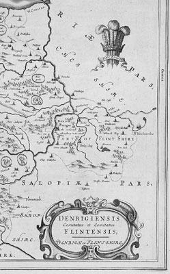
Denbigh & Flintshire, Wales (31034)
VIEW ITEM / MORE INFO
Cartographer : Joan Blaeu
Title : Denbigiensis comitatus et Comitatus Flintensis - Denbigh et Flintshire
Date : 1647
Size : 24in x 20in (610mm x 510mm)
Description :

This map of the Welsh counties of Denbigh & Flintshire was published in the 1647 Dutch edition of Joan Blaeus Atlas Novus. 
Blaeus reference for the topographical data for this map derive from John Speeds maps of Great Britain from the 1611 Empire of Great Britaine  -  the beautiful decoration, though, is distinctly Blaeus.
This is a beautiful map with a deep impression, original margins, wonderful hand colouring and strong, stable paper. (Ref: Koeman; Tooley)

General Description:
Paper thickness and quality: - Heavy and stable
Paper color: - White
Age of map color: - Early
Colors used: - Yellow, pink, red, blue, green
General color appearance: - Authentic
Paper size: - 24in x 20in (610mm x 510mm)
Plate size: - 19 1/2in x 15in (495mm x 380mm)
Margins: - Min 1in (25mm)

Imperfections:
Margins: - None
Plate area: - Light age toning along centrefold
Verso: - None

Condition : (A+) Fine Condition

Price :

Ref. No. :

US$525.00

31034

add to basket

payment
shipping
ask a question