Search the entire catalogue by entering a key search term in the ‘search’ box or browse our stock by selecting from the list of categories below.
MAPS BRITISH ISLES
![]()
ENGLAND
![]()
|
|||||||||||||
|
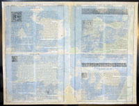
Cartographer : | John Speed | |||||||||||
| Title : | Holy Iland; Garnsay; Farne; Jarsey | ||||||||||||
| Date : | 1611 | ||||||||||||
| Size : | 21in x 16in (535mm x 405mm) | ||||||||||||
| Description : |
This finely engraved
beautifully hand coloured original antique map by John
Speed of the
English Islands of Holy & Farne Island's; Guernsey &
Jersey was published by John Sudbury & George Humbell in the 1611
1st edition of John Speeds famous atlas The
Theatre of the Empire of Great Britaine, first
published in 1611.
General Description: |
||||||||||||
| Condition : | (A) Very Good Condition | ||||||||||||
| Price :
Ref. No. : |
|||||||||||||
|
|||||||||||||