Search the entire catalogue by entering a key search term in the ‘search’ box or browse our stock by selecting from the list of categories below.
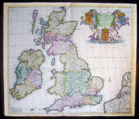
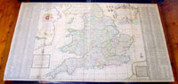
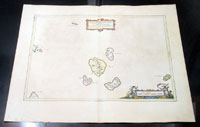
MAPS - BRITISH ISLES
![]()
|
||||||||
|
Cartographer : | Claude Ptolemy | ||||||
| Title : | Prima Europe Tabula | |||||||
| Date : | 1486 | |||||||
| Price : | P.O.A | |||||||
|
Ref. No. : |
92669 | |||||||

|
||||||||
|
Cartographer : | John Rocque | ||||||
| Title : | England and Wales Drawn from the Most Accurate Surveys...by John Rocque | |||||||
| Date : | 1761 | |||||||
| Price : | US$1,075.00 | |||||||
|
Ref. No. : |
92242 | |||||||

|
||||||||
|
Cartographer : | Theodore Danckerts | ||||||
| Title : | Novissima et Accuratissima Totius Angliae, Scotiae et Hiberniae Tabula | |||||||
| Date : | 1685 | |||||||
| Price : | ||||||||
|
Ref. No. : |
16366 | |||||||
|
||||||||
|
Cartographer : | Alexis Hubert Jaillot | ||||||
| Title : | Les Isles Britanniques; qui Contiennent les Royaumes d'Angleterre, Escosse, et Irlande...1696 | |||||||
| Date : | 1696 | |||||||
| Price : | ||||||||
|
Ref. No. : |
35010 | |||||||

|
||||||||
|
Cartographer : | J B Nolin | ||||||
| Title : | Les Isles Britanniques ou sont Les Royaumes d Angleterre d Escosse et d Irlande...J B Nolin | |||||||
| Date : | 1707 | |||||||
| Price : | US$975.00 | |||||||
|
Ref. No. : |
43171 | |||||||
|
||||||||
|
Cartographer : | Joan Blaeu | ||||||
| Title : | Sarnia Insula Vulgo Garnsey: et Insula Caesarrea vernacule Jarsey | |||||||
| Date : | 1659 | |||||||
| Price : | US$650.00 | |||||||
|
Ref. No. : |
43170 | |||||||

|
||||||||
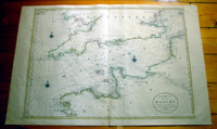
|
Cartographer : | Alexis Hubert Jaillot | ||||||
| Title : | Carte De La Manche faite par ordre du Roy..a Paris...1692 | |||||||
| Date : | 1692 | |||||||
| Price : | US$850.00 | |||||||
|
Ref. No. : |
16371 | |||||||
|
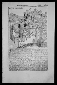
||||||||
|
Cartographer : | Hartmann Schedel | ||||||
| Title : | Anglie Provincia | |||||||
| Date : | 1493 | |||||||
| Price : | US$1,150.00 | |||||||
|
Ref. No. : |
35012 | |||||||
|
||||||||
|
Cartographer : | Isaac Tirion | ||||||
| Title : | Nieuwe Kaaart van de Eilanden Groot Britannie behelsende Het Koningryk Engeland | |||||||
| Date : | 1750 | |||||||
| Price : | US$375.00 | |||||||
|
Ref. No. : |
70087 | |||||||

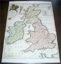
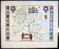
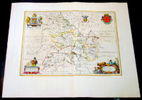
ENGLAND
![]()
|
||||||||
|
Cartographer : | J B Homann | ||||||
| Title : | Regionis quae est circa Londinum....Homaniamus Heredibus 1741 | |||||||
| Date : | 1741 | |||||||
| Price : | US$925.00 | |||||||
|
Ref. No. : |
92275 | |||||||

|
||||||||
|
Cartographer : | Henri Abraham Chatelain | ||||||
| Title : | Nouvelle Carte De L Angleterre Dans Laquelle Lon Observe Lez Comtez Les Archives | |||||||
| Date : | 1720 | |||||||
| Price : | US$475.00 | |||||||
|
Ref. No. : |
16370 | |||||||

|
||||||||
|
Cartographer : | Hermann Moll | ||||||
| Title : | The South Part of Great Britain called England & Wales...by Herman Moll 1710 | |||||||
| Date : | 1710 | |||||||
| Price : | US$849.00 | |||||||
|
Ref. No. : |
80662 | |||||||
|
||||||||
|
Cartographer : | Pieter Goos | ||||||
| Title : | Pascaarte van Engelant van t' Voorlandt tot aen Blakeney waer in te Sien is de Mont vande | |||||||
| Date : | 1676 | |||||||
| Price : | US$975.00 | |||||||
|
Ref. No. : |
42012 | |||||||

|
||||||||
|
Cartographer : | Joan Blaeu | ||||||
| Title : | Oxonium Comitatus, Vulgo Oxfordshire | |||||||
| Date : | 1647 | |||||||
| Price : | US$925.00 | |||||||
|
Ref. No. : |
92846 | |||||||
|
||||||||
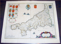
|
Cartographer : | Jaon Blaeu | ||||||
| Title : | Cornubia sive Cornwallia | |||||||
| Date : | 1637 | |||||||
| Price : | US$975.00 | |||||||
|
Ref. No. : |
50606 | |||||||
|
||||||||
|
Cartographer : | John Speed | ||||||
| Title : | Holy Iland; Garnsay; Farne; Jarsey | |||||||
| Date : | 1611 | |||||||
| Price : | US$849.00 | |||||||
|
Ref. No. : |
92499 | |||||||

|
||||||||
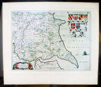
|
Cartographer : | Joan Blaeu | ||||||
| Title : | Episcopatus Dunelmensis Vulgo The Bishoprike of Durham | |||||||
| Date : | 1647 | |||||||
| Price : | US$549.00 | |||||||
|
Ref. No. : |
60009 | |||||||

|
||||||||
|
Cartographer : | Joan Blaeu | ||||||
| Title : | Ducatus Eboracensis Pars Orientalis - The East Reding of Yorkeshire | |||||||
| Date : | 1647 | |||||||
| Price : | US$549.00 | |||||||
|
Ref. No. : |
60008 | |||||||
|
||||||||
|
Cartographer : | Joan Blaeu | ||||||
| Title : | Insula Sacra Vulgo Holy Isand et Farne | |||||||
| Date : | 1647 | |||||||
| Price : | US$425.00 | |||||||
|
Ref. No. : |
60007 | |||||||

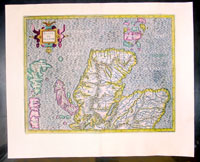
SCOTLAND
![]()
|
||||||||
|
Cartographer : | Joan Blaeu | ||||||
| Title : | Cantyra Chersonesus - Cantyr a Demie-yland.. | |||||||
| Date : | 1657 | |||||||
| Price : | US$425.00 | |||||||
|
Ref. No. : |
50384 | |||||||

|
||||||||
|
Cartographer : | Joan Blaeu | ||||||
| Title : | Insulae Quaedam Minores...Some of The Smaller Western Eyles lying between the Yles of Mule & Skye | |||||||
| Date : | 1657 | |||||||
| Price : | ||||||||
|
Ref. No. : |
50386 | |||||||
|
||||||||
|
Cartographer : | Gerard Mercator | ||||||
| Title : | Scotia Regnum | |||||||
| Date : | 1633 | |||||||
| Price : | ||||||||
|
Ref. No. : |
50395 | |||||||
IRELAND
![]()
|
||||||||
|
Cartographer : | Gerald Mercator | ||||||
| Title : | Irlandiae regnum | |||||||
| Date : | 1607 | |||||||
| Price : | US$975.00 | |||||||
|
Ref. No. : |
42003 | |||||||

|
||||||||
|
Cartographer : | Joan Blaeu | ||||||
| Title : | Baronia Udrone in Comitatu Cathergoughe | |||||||
| Date : | 1658 | |||||||
| Price : | US$375.00 | |||||||
|
Ref. No. : |
70161 | |||||||

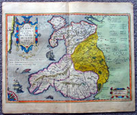
WALES
![]()
|
||||||||
|
Cartographer : | Gerard Mercator | ||||||
| Title : | Cambriae Typus Auctore Humfredo Lhuydo Denbigiense Cambrobritanno | |||||||
| Date : | 1607 | |||||||
| Price : | ||||||||
|
Ref. No. : |
42001 | |||||||
|
||||||||
|
Cartographer : | Joan Blaeu | ||||||
| Title : | Comitatus Brechiniae Breknoke | |||||||
| Date : | 1664 | |||||||
| Price : | US$475.00 | |||||||
|
Ref. No. : |
01-4244 | |||||||
|
||||||||
|
Cartographer : | Joan Blaeu | ||||||
| Title : | Denbigiensis comitatus et Comitatus Flintensis - Denbigh et Flintshire | |||||||
| Date : | 1647 | |||||||
| Price : | US$525.00 | |||||||
|
Ref. No. : |
31034 | |||||||

|
||||||||
|
Cartographer : | Joan Blaeu | ||||||
| Title : | Montgomeria Comitatus et Comitatus Mervinia | |||||||
| Date : | 1664 | |||||||
| Price : | US$525.00 | |||||||
|
Ref. No. : |
01-4004 | |||||||
