British Isles (89)

1486 Claude Ptolemy, Holle & Reger Antique Renaissance Map of Great Britain & Ireland - Rare
Antique Map
- Title : Prima Europe Tabula
- Date : 1486
- Size: 20 1/2in x 15 1/2in (552mm x 397mm)
- Condition: (A+) Fine Condition
- Ref: 92669
This original hand coloured wood-block engraved very early, rare antique map of Great Britain & Ireland was published in the 1486 Ulm edition & translation of Claudius Ptolemys (87-150) text, published in the 2nd edition of Lienhart Holles & by Johann Reger atlas Claudii Ptolomei .... Cosmographie ... Opus Donni Nicolai Germani Secvndvm Ptolomevm Finit, Ulm, Germany. (Shirley 5)
This is a unique & very rare map and only the 4th map of the British Isles printed, published only 47 years after Johannes Gutenbergs invention of the moveable type printing press in 1439.
The two edition of Lienhart Holles atlases were published in 1482 & 1486. The 1482 Ulm edition of Ptolemys Geographia was the first edition printed north of the Alps and the first to appear in color, applied by the publisher.
The 1482 Ulm edition was one of the most important cartographic texts of the early Renaissance and the first edition of the work to be printed outside Italy. The text for this edition was based upon a manuscript translated into Latin by Jacobus Angeli and edited by Nicolaus Germanus that had been brought to Ulm from Rome in 1468. The Ulm Ptolemy was published in 1482 by Lienhart Holle, the same year as Berlingheris Florence edition. Ashley Baynton Williams notes:.........Working independently of Berlinghieri, but apparently using the same or similar models, Holle also added modern maps of Spain, France, Italy and Palestine, but also the first printed map of Scandinavia, composed by Cornelius Clavus, circa 1425-7 . Holles maps were printed from woodcuts, and are characterised by heavy wash colouring for the sea areas, typically a rich blue for the 1482 edition, and an ochre for the 1486 edition. These bright colours, and the greater sense of age that woodcuts convey, make this series the most visually appealing of the Ptolemeic maps.........
Holle went bankrupt shortly after the original publication and the work was taken over by Johann Reger, who issued a second edition in 1486.
This large map is in fine condition on strong sturdy paper, the printing impression is heavy and clear. The colour is original and beautifully applied. There has been professional restoration to the L&R bottom corners. No loss of original paper and restrengthened on the verso. The centerfold has been re-strengthened, on the verso, with some light creasing and rippling.
General Condition:
Paper thickness and quality: - Heavy and stable
Paper color: - off white
Age of map color: - Original
Colors used: - Yellow, green, red, brown.
General color appearance: - Authentic and fresh
Paper size: - 20 1/2in x 15 1/2in (552mm x 397mm)
Image size: -14 1/2in x 14 1/2in x 20 1/4in (369mm x 369mm (upper margin) 511 mm (lower margin)
Margins: - Min 1/4in (6mm)
Imperfections:
Margins: - Light discolouration & soiling.
Plate area: - Bottom L&R corners restored, no loss. Light creasing and rippling
Verso: - Re-enforced along center-fold and L&R bottom corners
Background: The first editions of Ptolemys Geographia Atlas was published in Italy in 1477 and republished in 1478 & 1482. The next atlas to be published was north of the Alps by Lienhart Holle, in Ulm, Germany in 1482. Holles maps were printed from woodcuts, and are distinct with their heavy wash colouring for the sea areas, typically a rich blue for the 1482 edition, and an ochre for the 1486 edition. These bright colours, and the greater sense of age that woodcuts convey, make this series of maps one of the most visually attractive.
Claudius Ptolemy: (87-150) was an Egyptian astronomer and geographer living and studying in Alexandria. Alexandria was not only the home of the greatest library of any period, but was also one of the most important trade centres between west and east - here Ptolemy could not only study ancient authorities, but could also consult contemporary travellers and merchants. From this wealth of accumulated knowledge, Ptolemy composed his <i>Geographia</i>, a work of considerable genius, which dominated the whole of the Christian and Moslem world for 1,500 years (Tooley).
It was Ptolemy who introduced the concept of latitude and longitude to form a grid to cover the whole world, so that it would be possible to plot the position of principal land-marks on the map by observations, and then fill in other information from other sources, including the notes and Itinerary of Marinus of Tyre, perhaps the most accurate source available.
Unfortunately Ptolemy was hampered by the paucity of observations - as a result he exaggerated the length of the Mediterranean by over 20 degrees -and by lack of information which was often circumvented by invention. Despite these errors, which persisted for nearly 1,500 years, the work was of fundamental importance at a time when little was being done in the way of modern mapping. As a result of this work, which was so far in advance of anything before or anything produced in the next 1,500 years, Ptolemy has earned the reputation and accolade, the father of geography (Tooley).
Re-discovery of the Ptolemy Texts: Following the fall of the Roman Empire, Ptolemys text was lost to western geographers. The earliest extant manuscript version of the Geographia is Arabic, and probably dates from the 12th Century. Subsequently, the text was translated into Greek, and circulated through the Greek World. In about 1400 a Greek manuscript came into the hands of the Byzantine scholar, Emanuel Chrysolaras, who was working in Italy. Chrysolaras undertook a translation of the text into Latin, and completed by his pupil Jacopo dAngelo, in 1406. The Greek manuscript that Angelo translated was apparently lacking maps, but the data in the text contained the information to construct a set of maps, and numbers of scholars set about such work. Of them, the most influential, was Donnus Nicolaus Germanus, a German cartographer, active in Italy from the 1460s to 1480s. He was a prolific editor of the text and maps, and his work formed the basis for three of the four sets of Ptolemaic maps printed in the fifteenth Century, with the fourth, accompanying Berlinghieris Geographia, strongly influenced by him .
The first printed versions of Ptolemys Text: The first published edition of the Geographia with maps, which were probably engraved by Taddeo Crivelli, was issued in Bologna in 1477. Conrad Sweynheym was also working on an edition of Ptolemy in Rome in the same period. After his death, Arnold Buckinck, saw the atlas through the press, in 1478. Of the engraved editions of Ptolemys Cosmographia the maps in the Rome edition are the finest fifteenth century examples, and second only to Mercators maps, from his 1578 edition. The atlas proved popular, and three successive editions (to 1508) followed. In 1482, Nicolas Laurentii published a set of Ptolemaic maps to illustrate Francesco Berlinghieri Geographia.
The first edition of Ptolemys Geographia printed outside Italy was published by Lienhart Holle, in Ulm, also in 1482. Holles maps were printed from woodcuts, and are characterised by heavy wash colouring for the sea areas, typically a rich blue for the 1482 edition, and an ochre for the 1486 edition. These bright colours, and the greater sense of age that woodcuts convey, make this series the most visually appealing of these various sets of maps.
Later Editions of Ptolemy: Next in chronological sequence, and the most unusual of the editions of Ptolemy, was that published by Jacobus Pentius de Leucho in Venice in 1511, edited by Bernardus Sylvanus. Martin Waldseemullers edition of Ptolemy, first published in 1513, is the most important of the sixteenth century editions. Waldseemullers edition was reprinted in 1520, and then the maps were re-drawn by Lorenz Fries on a smaller format, for editions published in 1522, 1525, 1535 and 1541. The next to produce an edition of Ptolemy was Sebastian Munster, who worked in Basle. Munster was one of the leading geographers and cartographers of his period, and he diligently set about revising and improving the maps. Giacomo Gastaldi, one of the leading cartographers of the sixteenth century, composed a set of maps for an edition of the Geographia, published in Venice in 1548. Of all the editions of Ptolemy, that prepared by Gerard Mercator, and published in 1578, is technically the finest, with the World map being a particularly fine engraving. This atlas is, also, noteworthy for its longevity, the original printing plates were still in use in 1730, over one hundred and fifty years after they were first engraved. (Ref: Shirley 5; Stevenson; Tooley; M&B; MapForum)
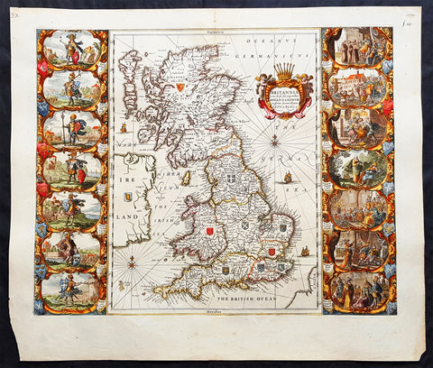
1646 Jan Jansson Antique Heptarchy Map of Great Britain & Ireland - Christianity in England
- Title : Britannia prout divisa suit temporibus Anglo-Saxonum præsertim durante illorum Heptarchia
- Ref #: 82076
- Size: 23 1/2in x 20in (595mm x 510mm)
- Date : 1646
- Condition: (A+) Fine Condition
Description:
This magnificent hand coloured original copper-plate engraved antique map of Britain during the reign of the Saxon Kings between 500 - 700AD - know as the Heptarchy Era - was published by Jan Jansson in his 1646 edition of Atlas Nouvs, blank verso.
Of the three iterations of this map by John Speed, Joan Blaeu and Jansson, this is considered by many to be the most accomplished. It is distinguishable from the others with the inclusion of compass roses & rhumb lines, sailing ships and the Irish escutcheon.
General Definitions:
Paper thickness and quality: - Heavy and stable
Paper color : - off white
Age of map color: - Early
Colors used: - Yellow, green, blue, pink
General color appearance: - Authentic
Paper size: - 23 1/2in x 20in (595mm x 510mm)
Plate size: - 20 1/2in x 16 3/4in (520mm x 425mm)
Margins: - Min 1in (25mm)
Imperfections:
Margins: - Light age toning in margins, old ink price top right
Plate area: - None
Verso: - None
Background:
Splendid map of Anglo-Saxon Britain flanked by intricately rendered portraits of the kings through the 5th through 7th centuries. The monarchs to the left are those of the pre-Christian era, while those on the right are depicted receiving Christianity or being martyred for its sake.
This is often called the Heptarchy Map, as it presents England during the time following the Anglo Saxon conquest of southern England, approximately 500 to 850 A.D. known as the Heptarchy Era. (The word itself refers to the seven kingdoms that would eventually combine to form the Kingdom of England in the 10th century.)
To the left are the seven full length figures of the first aspiring Saxon Kings with their escutcheons, armies or townships;
1. Hengist - Kent 456AD
2. Ella - South Saxon 478AD
3. Cherdin - West Saxon 519AD
4. Erkenwin - East Saxon 527AD
5. Ida - Northumberland 582AD
6. Uffa - East Angle 546AD
7. Creda - Mercian 575AD
On the right there are scenes showing the conversion of Saxon sovereigns to Christianity:
1. Ethelbert - Kent 595AD receiving religious instruction from St Augustine
2. Sebert - East saxon604AD re-consecrating the temples of Diana and Apollo that later become St Pauls London and St Peters Westminster
3. Epenwald - East Angle 624AD embracing baptism by the armed exhortation of King Edwin of Northumberland
4. Edwin - Northumberland 627AD stirred by a vision to receive the faith
5. Kengils West Saxon 635AD converted by the preaching of St Berinus
6. Peada Mercia 650 receiving the Faith by the persuasion of King Osway of Northumberland but also being murdered by his own mothers, some say his wifes, procurement.
7. Ethenwolfe South Saxon 662AD being baptised at Oxford by St Berinus (Ref Shirley, Tooley, M&B)

1611 John Speed 1st Edition Map of Great Britain & Ireland - London & Edinbugh
- Title : The Kingdome of Great Britaine and Ireland....Graven by J Hondius and are to be solde by J Sudbury and George Humble in Pope Heads Alley in London cum privilage Regis 1610
- Ref #: 93433
- Size: 21in x 15 3/4in (535mm x 400mm)
- Date : 1611
- Condition: (A) Very Good Condition
Description:
This magnificent, beautifully hand coloured, original copper-plate engraved antique map (a true rare 1st edition - Shirley 316, catch word wee on verso) by John Speed, was engraved by the famous cartographer Jodocus Hondius and published by Sudbury & Humble in Speeds 1611-12 edition of his atlas Theatre of the Empire of Great Britaine.
A beautiful example of the first state of one the most visually striking maps ever produced of the British Isles, embellished with finely detailed views of both London and Edinburgh. The strong printing impression of this example highlights the exquisite engraving of this map, particularly the delicate detail of the two inset views.
General Definitions:
Paper thickness and quality: - Heavy and stable
Paper color : - off white
Age of map color: - Original
Colors used: - Yellow, green, blue, pink
General color appearance: - Authentic
Paper size: - 21 1/2in x 17in (545mm x 435mm)
Plate size: - 18 1/2in x 14in (470mm x 355mm)
Margins: - Min 1/2in (12mm)
Imperfections:
Margins: - All margins professionally restored from printed borders
Plate area: - Small repair to bottom centerfold
Verso: - Centerfold re-enforced.
Background:
John Speed spent 15 years gathering materials for his atlas of the British Isles, in which this map was the first to appear. Moreover, Speed went to considerable lengths to secure a top engraving talent—a fascinating story in itself--to produce this and many of the other maps in this atlas. Speed sent the visual, raw materials for his maps—drafts of the map themselves and design sketches--to Amsterdam to be engraved by Jodocus Hondius, who at the time was one of the most prominent and successful map publishers in all of Europe. Hondius, however, was well known to English map publishers, as he had worked as an engraver for hire in London in the 1580’s, where he had fled due to religious persecution in his homeland. Still, it is surprising that Speed was able to secure the services of Hondius at the height of his career, and, in fact, Hondius died shortly after completing this project. Hondius’ distinctive style can be seen in this map in its stippled seas and in its decorative detail that is rich without being disorganized or distracting.
The map itself of England was based on that of Saxton, who produced some years earlier the very first atlas of Great Britain. Ireland and Scotland were based on maps by Hondius and Mercator, respectively. The view of London was modeled after a c. 1600 drawing by C. J. Visscher, which was not published until 1616. The Edinburgh view is an adaptation of an earlier manuscript showing the city under siege in 1544.

1628 Gerard Mercator Original Antique Map of Ireland - Irlandiae Regnum
- Title : Irlandiae regnum
- Date : 1628
- Ref: 61003
- Size: 22 1/2in x 19in (570mm x 485mm)
- Condition: (A+) Fine Condition
Description:
This fine beautifully hand coloured original antique map of Ireland by Gerald Mercator was published by Rumold Mercator & Jodocus Hondius in the early 1628 French edition of Mercators Atlas.
This map is magnificent with beautiful original hand colouring, large original margins with a heavy impression on clean, stable paper. Original colouring such as this is scarce and hard to find.
These maps, published in the early editions of Mercators atlas, are the original maps drawn and engraved by Gerald Mercator in the mid to late 16th century and were published by his sons Rumold & Henricus, after his death in 1595. After two editions the plates were purchased by Jodocus Hondius in 1604. He continued to publish them until the mid 1630\'s when some of the plates were re-engraved or replaced by Jan Jansson and Henricus Hondius.
General Definitions:
Paper thickness and quality: - Heavy and stable
Paper color : - off white
Age of map color: - Original
Colors used: - Orange, yellow, blue, red
General color appearance: - Authentic
Paper size: - 22 1/2in x 19in (570mm x 485mm)
Plate size: - 17 1/2in x 14in (420mm x 330mm)
Margins: - Min 2in (50mm)
Imperfections:
Margins: - None
Plate area: - None
Verso: - None
Background:
The earliest maps of Ireland up to the year 1500 or so share the shortcomings of those of the rest of the British Isles especially as represented on world maps. It was not to be expected that lands literally on the very edge of the known world could be depicted with any accuracy; very often one feels that the cartographers or engravers placed the islands in the nearest available space consistent with their imagined position. Even in the first printed Ptolemaic map there is still much distortion in Ireland\'s shape and geographical position but, on the other hand, a quite surprising number of place names and other details are shown, as many, in fact, as in the rest of Britain put together. This detailed knowledge is not as puzzling as it might appear, for the Ptolemy maps, at least the later editions from 1513 onwards, were based on Italian portulan charts and these, in turn, reflected knowledge gained during the long commercial relationship which had existed between Italy and Ireland ever since the thirteenth century. The distortions on land-surveyed maps remained uncorrected until late in the seventeenth century but a quite accurate coastal outline was given in the marine atlases of Waghenaer, Dudley, Blaeu and later Dutch chart makers.
Apart from a few manuscript maps and very rare maps printed in Rome and Venice (George Lily, 1546, and others in the period 1560-66) Ireland is shown on Mercator\'s large map of the British Isles (1564), and in his Atlas (1595) and as a separate sheet in the Ortelius atlases (from 1 573). The most important map, however, was compiled by an Italian, Baptista Boazio, probably in the 1 5 8os. This has survived in manuscript form and may have been used by Pieter van der Keere for a map published by Jodocus Hondius in 1591. Boazio\'s map was subsequently published by John Sudbury, who later sold Speed\'s maps, and this version was included in editions of the Ortelius atlases from 6oz onwards. The Boazio map is a quite splendid map, very decorative, some copies even showing an Eskimo complete with kayak and hunting spear. Thereafter the trend is familiar: Camden, Speed, Blaeu, Jansson, Sanson and others of the Dutch and French schools all included a general map or maps of the Irish provinces in their atlases. Speed\'s map of the whole of Ireland was based at least partly on surveys by Robert Lythe (c.1570) and Francis Jobson (c.1590) and included figures in national costume; it was for long regarded as the best map available and was much copied by publishers in other countries.
In 1685 the first atlas of Ireland to match Saxton\'s At/as of Eng/andand Wales was published by Sir William Petty as Hiberniae Detineaho, the result of a highly organized and detailed survey (the \'Down\' survey) carried out in the years following 1655. Re-issued in miniature form soon afterwards by Francis Lamb, Petty\'s Atlas was widely used as the basis for practically all maps of Ireland produced by English, French, Dutch and German publishers in the following century. Apart from re-issues of Petty\'s Atlas and its many copyists there were maps by George Grierson, a Dublin publisher, John Rocque, the Huguenot surveyor and engraver who spent some years in Dublin, and Bernard Scale, Rocque\'s brother-in-law.
Towards the end of the century many large-scale maps were published but, as in England, private mapping was gradually overtaken and eventually replaced by the Ordnance Survey maps produced between the years 1824 and 1846.(Ref: Koeman, Tooley)
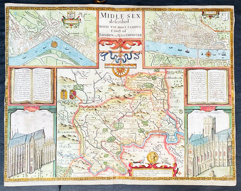
1676 John Speed Antique Map of County of Midlesex Views London & Westminster
- Title : Midle-sex Described with the most Famous Cities of London and Westminster
- Date : 1676
- Size: 21in x 16in (535mm x 405mm)
- Condition: (A) Very Good Condition
- Ref: 35602
Description:
This original hand coloured copper plate engraved antique map & views of London and the English county of Middlesex by John Speed was published in the 1676 Bassett & Chiswell edition of Speeds famous atlas The Theatre of the Empire of Great Britaine.
The map is embellished with the famous birds-eye views of London, Westminster and the churches of St Peters (Westminster Abbey) and old St Pauls before the great fire of London in 1666. English descriptive text of London on the verso.
General Definitions:
Paper thickness and quality: - Heavy and stable
Paper color : - off white
Age of map color: - Original
Colors used: - Blue, yellow, green, pink
General color appearance: - Authentic
Paper size: - 21in x 16in (535mm x 405mm)
Plate size: - 20 1/2in x 15 1/2in (520mm x 395mm)
Margins: - Min 1/2in (10mm)
Imperfections:
Margins: - Light age toning
Plate area: - Re-enforced along centerfold, light uplift
Verso: - Re-enforced along centerfold, two small repair to top of map, no affect to image
Background:
This county map of Middlesex, now greater London, illustrates the market towns of Enfield, Pancras, Osterley and Staines. The map is dominated by four large vignettes with the environs of London and the county situated in the central portion of the map. The actual cartography is based on the surveys performed by John Norden, the earlier English antiquary and map maker, who unsuccessfully attempted to publish an updated county atlas of the United Kingdom before Speed. Norden also lived most of his life in Middlesex, thus becoming an obvious source for the map.
The City of London is clearly shown on the lower right of the map with villages such as Hamsted, Pancras, Kensington and Paddington marked around the city. To the lower centre of the map is an acknowledgement to the original survey by Norden, augmented by Speed himself.
Although the cartography is of some note, it is the vignettes for which this map is justly famous. To the two bottom corners are the famous Churchs of St. Peter (Westminster Abbey) Westminster on the left and St. Pauls to the right. This is the medieval Cathedral of St. Pauls, just after it had lost its spire in 1561 and before the Great Fire of 1666, in which it was destroyed then rebuilt in its present form by Sir Christopher Wren. Above these two church vignettes are two text panels in the form of books, the one on the left describing the two churches and the other on the right with a description of London itself.
Finally, two large vignettes on the upper left and right corners depict the two cities of Westminster and London respectively. It is believed that Speed was not responsible for either of these images, more likely drawing from Norden, although there are no surviving evidence of this, to date yet to be found. There are also theories that these two views may have come from either a German sources or other lost birds-eye views of London by unknown persons.
Due to modern growth of London and border changes, the county of Middlesex no longer exists, but there is little doubt this is the most the best map of London and Middlesex published in the 17th century. English text on verso

1560 Sebastian Munster Antique Map England Wales Scotland Ireland
- Title : Das Kunigreich Engellandt mit dem Anstossenden Reich Schottlandt so vor Zeiten Albion und Britannia haben Geheissen
- Ref #: 93415
- Size: 15 1/2in x 12in (395mm x 305mm)
- Date : 1560
- Condition: (A) Very Good Condition
Description:
A great example of the first map of England, Wales & parts of Scotland and Ireland was published in the 1560 edition of Sebastian Munsters Cosmographey oder beschreibung aller Länder
This original wood block engraved antique map is instantly recognisable, first published in 1540.
General Definitions:
Paper thickness and quality: - Light and stable
Paper color : - off white
Age of map color: -
Colors used: -
General color appearance: -
Paper size: - 15 1/2in x 12in (395mm x 305mm)
Plate size: - 15 1/2in x 12in (395mm x 305mm)
Margins: - Min 1/2in (12mm)
Imperfections:
Margins: - Thumb marks bottom right margin, small holes in bottom margin centerfold
Plate area: - Page rejoined bottom left side, no loss
Verso: - Light soiling
Background:
The first edition of Munsters first printed separate map of England and Wales, with Scotland as far north as Edinburgh, the east coast of Ireland and north coast of France. North oriented to the left. The map primarily identifies Cathedral towns. A key in the upper left corner shows the English and Latin names for 17 major place names in England. The flags of both England and Scotland are shown.

1646 Joan Blaeu Antique Map of Ireland - Hibernia Regnum
- Title: Hibernia Regnum Vulgo Ireland
- Date: 1646
- Condition: (A+) Fine Condition
- Ref # : 50673
- Size: 23 1/2in x 20in (600mm x 510mm)
Description:
This superbly hand coloured original antique map of Ireland - Hibernia - was published in the 1646 Dutch edition of Joan Blaeu's Atlas Novus.
One of the best I have seen to date, the original colouring is superb and the paper is heavy and stable with original margins.
General Description:
Paper thickness and quality: - Heavy
Paper color: - White
Age of map color: - Original
Colors used: - Yellow, pink, red, blue, green
General color appearance: - Authentic
Paper size: - 23 1/2in x 20in (600mm x 510mm)
Plate size: - 19 3/4in x 15 1/4in (505mm x 385mm)
Margins: - Min 2in (50mm)
Imperfections:
Margins: - Very bottom of margin re-joined, not affecting image
Plate area: - None
Verso: - None
Background:
This is Willem Blaeu's highly decorative general map of Ireland and is coloured to show in outline the ancient provinces of Connaught, Leinster, Munster and Ulster each of which together with the map of Carlow, was given a separate map in a section at the end of the atlas volume devoted to Scotland.
The map, which Blaeu first issued in 1635 (twenty years prior to the publication of the Scotland and Ireland volume) was based on that published by John Speed in 1611 in his Theatre of the Empire of Great Briatine. In its turn Speed's map was copied Hondius and Blaeu's great rival Jan Jansson. It was the latter version that Willem Blaeu used. His beautifully balanced design is complemented by the Royal arms and the relatively simple title cartouche at the left hand side. (Ref: Koeman; Tooley; M&B)
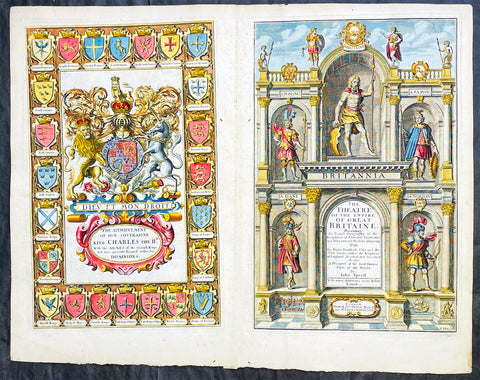
1676 John Speed Antique Atlas Title Pages x 2 Empire of Great Britaine & World
- Title : The Theatre of the Empire of Great Britaine, A Prospect of the most famous Parts of the World by John Speed...London Thomas Bassett and Richard Chiswell 1676; The Achievement of our Soveraigne King Charles the 11D.
- Date : 1676
- Size: 22 1/2in x 17 1/2in (570mm x 445mm)
- Ref #: 42005/42006
- Condition: (A+) Fine Condition
- Price: $1250.00US
Description:
This original beautifully hand coloured, copper plate engraved antique Title and Dedication Pages was published for the 1676 edition of John Speeds double atlas The Theatre of the Empire of Great Britaine & Atlas A Prospect of the most Famous Parts of the World printed by Thomas Bassett and Richard Chiswell, London.
General Definitions:
Paper thickness and quality: - Heavy and stable
Paper color : - off white
Age of map color: - Later
Colors used: - Yellow, green, blue, pink
General color appearance: - Authentic
Paper size: - 22 1/2in x 17 1/2in (570mm x 445mm)
Plate size: - 15 1/4in x 9 3/4in (385mm x 250mm) each
Margins: - Min 1/2in (12mm)
Imperfections:
Margins: - Light age toning
Plate area: - Light age toning
Verso: - Light age toning
Background:
John Speeds The Theatre of the Empire of Great Britaine was published in 1610/11 by John Sudbury and George Humble, and contained the first set of individual county maps of England and Wales besides maps of Ireland and a general map of Scotland. Most, but not all, of the county maps have town plans on them; those showing a Scale of Passes being the places he had mapped himself. The county maps were the first consistent attempt to show territorial divisions, such as boundaries of hundreds, but it was Speed’s town plans that were a major innovation and probably his greatest contribution to British cartography. The Theatre was an immediate success: the first print run of around 500 copies must have sold quickly because many editions followed. Sudbury and Humble realized, given the increasing popularity of both county and world atlases and in the light of the success of Abraham Ortelius’s Theatrum Orbis Terrarum, the potential demand for an English world atlas.
In 1627, two years before his death, Speed published Prospect of the Most Famous Parts of the World with 21 finely engraved maps, which was the first world atlas produced by an Englishman. There is a fascinating text describing the areas shown on the back of the maps in English, although a rare edition of 1616 of the British maps has a Latin text – this is believed to have been produced for the Continental market. Its maps are famous for their bordering panels of national characters in local costume and panoramic views depicting the areas of major towns and cities. Much of the engraving was done in Amsterdam at the workshop of Jodocus Hondius. The maps of the world and America show California as an island and are amongst the earliest ever printed to depict this seventeenth-century cartographic myth.

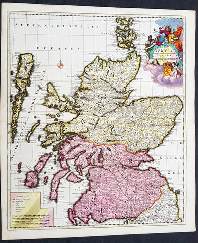
1646 Joan Blaeu Large Antique Map of Scotland - Scotia Regnum
- Title : Scotia Regnum
- Ref #: 61001
- Size: 22 3/4in x 19 3/4in (580mm x 500mm)
- Date : 1646
- Condition: (A+) Fine Condition
Description:
This large beautifully hand coloured original antique map of Scotland was published in the 1646 Dutch edition of Joan Blaeu's Atlas Novus.
General Description:
Paper thickness and quality: - Heavy
Paper color: - White
Age of map color: - Original
Colors used: - Yellow, pink, red, blue, green
General color appearance: - Authentic
Paper size: - 22 3/4in x 19 3/4in (580mm x 500mm)
Plate size: - 20in x 15 1/4in (510mm x 385mm)
Margins: - Min 1in (25mm)
Imperfections:
Margins: - None
Plate area: - None
Verso: - None
Background: When the Blaeu's published Volume V - GB & Ireland - of Atlas Novus, Scotland became one of the best-mapped countries in the world. Volume V contained forty-eight plates showing forty-nine separate maps of Scotland (plus a map of Ptolemy British Isles and six maps of Ireland). The first two plates from the atlas show the entire country ancient and modern, whilst the remaining forty-six plates cover most Scotland in forty-seven regional maps. In total the regional maps locate some 20,000 different place names. A clue as to the reason for this extraordinary explosion of geographical information is to be found on thirty-six of the regional maps, which all carry engraved credits to Timothy Pont (1524-1606)
Pont was responsible for surveying the greater part of Scotland between 1583-1600, the resulting Pont Manuscript maps were never published but were put to good use some fifty to seventy years later by Robert Gordon and Joan Blaeu. (Ref: Koeman; Tooley; M&B)

1759 Delarochette & Kitchin 1st Edition Antique Map of Germany Central Europe - Rare
- Titles: Map of the Empire of Germany, Including All the States Comprehend under that name: with the Kingdom of Priussia &c.
Sizes: 48 1/2in x 41in (1.230m x 1.040m) - Condition: (A+) Fine Condition
- Date: 1759
- Ref #: 93418
Description:
This stunning very large, scare and original copper-plate engraved antique 1st edition wall map of Germany, Bohemia, Austria, Prussia, Poland, Hungary, Netherlands and Northern Italy by the English cartographers Louis d arcy Delarochette & Thomas Kitchin (engraver) was published by Robert Sayer in 1759.
Incredibly detailed map of central Europe showing political boundaries as they were in the mid 18th century. Much detail noting roadways, towns, castles, monasteries, forests, swamps, rivers, towns, cities, mountains and much more. An incredible insight into mid 18th century Europe.
General Definitions:
Paper thickness and quality: - Heavy and stable
Paper color : - off white
Age of map color: - Original
Colors used: - Yellow, green, blue, pink
General color appearance: - Authentic
Paper size: - 48 1/2in x 41in (1.230m x 1.040m)
Plate size: - 48 1/2in x 41in (1.230m x 1.040m)
Margins: - Min 1/2in (12mm)
Imperfections:
Margins: - None
Plate area: - None
Verso: - None
Background:
Louis d Arcy Delarochette 1731 - 1802 was a British cartographer active in the mid to late 18th century. Collaborated with many famous British cartographers including Kitchin, Faden, Laurie & Whittle and Thomas Jefferies. Well know for his large scale maps.
Robert Sayers 1724 - 1794 was an important English map publisher and engraver active from the mid to late 18th century. Sayer was born in Sunderland, England, in 1725. He may have clerked as a young man with the Bank of England, but this is unclear. His brother, James Sayer, married Mary Overton, daughter-in-law of John Overton and widow of Philip Overton. Sayer initially worked under Mary Overton, but by December of 1748 was managing the Overton enterprise and gradually took it over, transitioning the plates to his own name. When Thomas Jefferys went bankrupt in 1766, Sayer offered financial assistance to help him stay in business and, in this way, acquired rights to many of the important Jefferys map plates as well as his unpublished research. From about 1774, he began publishing with his apprentice, John Bennett (fl. 1770-1784), as Sayer and Bennett, but the partnership was not formalized until 1777. Bennett retired in 1784 following a mental collapse and the imprint reverted to Robert Sayer. From 1790, Sayer added Robert Laurie and James Whittle to his enterprise, renaming the firm Robert Sayer and Company. Ultimately, Laurie and Whittle partnered to take over his firm. Sayer retired to Bath, where, after a long illness, he died. During most of his career, Sayer was based at 53 Fleet Street, London. His work is particularly significant for its publication of many British maps relating to the American Revolutionary War. Unlike many map makers of his generation, Sayer was a good businessman and left a personal fortune and great estate to his son, James Sayer, who never worked in the publishing business.

1639 Mercator & Hondius Large Old, Antique Map of Wales, GB - Humphrey Llwyd
- Title : Cambriae Typus Auctore Humfredo Lhuydo Denbigiense Cambrobritanno
- Date : 1639
- Size: 23in x 19in (590mm x 485mm)
- Ref #: 43139
- Condition: (A+) Fine Condition
Description:
This beautifully hand coloured original antique map of Wales - dedicated to its original creator the Welsh cartographer Lhuyd Humphrey - by Gerard Mercator was published by Jodocus Hondius in the 1639 French edition of Mercators Atlas.
One of the best examples I seen of this map to date, beautiful original hand colour with strong sturdy paper with a deep strong impression.
Humphrey Llwyd (also spelled Lhuyd) (1527–1568) was a Welsh cartographer , author, antiquary and Member of Parliament. He was a leading member of the Renaissance period in Wales along with other such men as Thomas Salisbury and William Morgan.
Llwyd was born in Denbigh, the county seat of the then county of Denbighshire at Foxhall, his family's estate. His father, Robert Llwyd, was descended from Harry Rossendale, henchman and grantee of the Earl of Lincoln. The first of the family that came to Wales from England appears to have been Foulk Rosindale, from whom Foxhall, or Foulk's Hall, was called. He married into the family of the Llwyd's of Aston, and probably from where his descendants derived their name, as well as their extraction from Einion Evell of the 12th Century. Einion Evell, Lord of part of Cynllaith, resided at Llwyn y Macn, in the parish of Oswestry. He and his twin brother, Cynwrig Evell, Lord of Y Glwyegl in Maelor Gymraeg, were the illegitimate sons of Madog ab Maredydd, Prince of Powys, by Eva, daughter of Madog (ab Einion Hael) ab Urien of Macn Gwynedd, ab Eginirab Lies ab Idnerth Benvras, Lord of Maesbrwg.
As a young man, he was educated at Brasenose College, Oxford and fared so well in the sciences and engineering that he was given a position as a physician to the Earl of Arundel during the Earl's tenure as Chancellor of the university. He was MP for East Grinstead during Elizabeth I's first parliament (1559).
In 1563, Llwyd returned to Denbigh and lived at Denbigh Castle at the permission of Sir John Salusbury who was then the Lord of the Manor of Denbigh. That year, he was elected MP for Denbigh Boroughs during Elizabeth's second Parliament where he promoted an act allowing the translation of the Bible into Welsh.
From 1566 he toured Europe, including Brussels, Augsburg, Milan, Padua and Venice. In Antwerp, he learnt from, and collaborated with, map maker Abraham Ortelius. In 1567, when Llwyd returned to Denbigh, he was given a stipend from the Crown to create the first printed map of Wales.
Llwyd died in 1568 and is buried in Whitchurch, a small chapel on the outskirts of Denbigh
Jodocus Hondius (1563 - 1612), one of the most notable engravers of his time, is known for his work in association with many of the cartographers and publishers prominent at the end of the sixteenth and the beginning of the seventeenth century.
In 1604 Hondius bought the plates of Mercator's Atlas which, in spite of its excellence, had not competed successfully with the continuing demand of the Ortelius Theatrum Orbis Terrarum.
To meet this competition Hondius added about 40 maps to Mercator's original number and from 1606 published enlarged editions in many languages, still under Mercator's name but with his own name as publisher. These atlases have become known as the Mercator/Hondius series. The following year the maps were re-engraved in miniature form and issued as a pocket Atlas Minor.
After the death of Jodocus Hondius the Elder in 1612, work on the two atlases, folio and miniature, was carried on by his widow and sons, Jodocus II and Henricus, and eventually in conjunction with Jan Jansson in Amsterdam. In all, from 1606 onwards, nearly 50 editions with increasing numbers of maps with texts in the main European languages were printed. (Ref: Koeman; M&B; Tooley)
Condition Report:
Paper thickness and quality: - Heavy & stable
Paper color: - off white
Age of map color: - Original
Colors used: - Yellow, pink, green, blue
General color appearance: - Authentic
Paper size: - 23in x 19in (590mm x 485mm)
Plate size: - 19 1/2in x 14in (500mm x 360mm)
Margins: - Min 1in (25mm)
Imperfections:
Margins: - Light toning to bottom of margin
Plate area: - None
Verso: - None
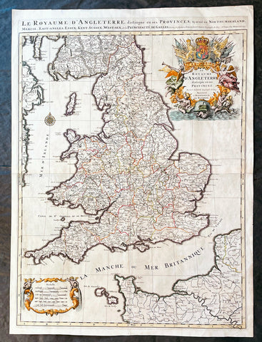
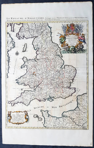
1693 Alexis Hubert Jaillot Large 1st Edition Antique Map of England & Wales
- Title : Le Royaume d'Angleterre Distingue en Ses Provinces...1693
- Size: 33in x 24in (840m x 610mm)
- Condition: (A+) Fine Condition
- Date : 1693
- Ref #: 17059
Description:
This large beautifully hand coloured original 1693 1st edition antique map of England & Wales by A H Jaillot - after Nicolas Sanson - was engraved in 1693 - the date is engraved in the title and was published by Jaillot in his large elephant folio Atlas Nouveau.
An original first state of this handsome map of England and Wales, that includes the east coast of Ireland's, southern Scotland, the Channel Islands, and a stretch of French coastline south to Paris. England and Wales are divided into their local counties, with highly detailed information on towns, cities, rivers, and topographical information.
The stunning decorative title cartouche features the United Kingdom coat-of-arms with a banner underneath reading Je Maintiendray ("I will maintain," which is strangely enough the motto of the Netherlands), along with trumpeting angels, mermen, and symbols of military might. A second cartouche flanked by putti encloses the six distance scales. A compass rose capped with a fleur-de-lis appears in the Irish Sea. Jaillot, in partnership with the sons of Nicolas Sanson, re-engraved Nicolas's Sanson's map on a larger scale in the 1680's. This particular map was published a few years later in the 1690's, and while based on Sanson's cartography (who is credited in the cartouche), it is a Jaillot composition. Also included is an alternate title running along the top neatline: Le Royaume d'Angleterre, Distingue en Ses Provinces; Scavoir en Northumberland, Mercie, East-Angles, Essex, Kent, Sussex, West-Sex, et la Principaute de Galles.
General Definitions:
Paper thickness and quality: - Heavy and stable
Paper color : - off white
Age of map color: - Original & later
Colors used: - Yellow, green, blue, pink
General color appearance: - Authentic
Paper size: - 33in x 24in (840m x 610mm)
Plate size: - 31 1/4in x 23in (795mm x 585mm)
Margins: - Min 1in (25mm)
Imperfections:
Margins: - None
Plate area: - None
Verso: - None
Background:
English Cartography: When considering the work of English map makers we tend, perhaps, to think too much in terms of county maps, dominated by the names of Saxton and Speed, but we should not underrate the contribution to the sum of geographical knowledge made in other spheres, such as the sea charts of Edward Wright, Robert Dudley and Greenvile Collins, the discoveries of James Cook, the road maps of Ogilby and Cary, the meteorological and magnetic charts compiled by Edmund Halley, to mention only a few.
In 1558 Queen Elizabeth came to the throne in the midst of a fast changing world. In 1563 a nineteen sheet map, copies of which survive only in manuscript form, was completed by Laurence Nowell, and no doubt, the issue of Mercator's large-scale map of the British Isles in 1564 had an important influence on the thought of the period. A few years later a national survey was commissioned privately, although probably at the instigation of Lord Burghley, the Lord Treasurer, but subsequently was completed with royal encouragement. The outcome was Christopher Saxton's Atlas of EngIand and Wales, started about 1570 and published in 1579 - the first printed set of county maps and the first countrywide atlas on such a splendid scale produced anywhere. A Welsh antiquarian, Humphrey Lhuyd completed a set of surveys that were even more successful than Saxton in which he had produced fine manuscript maps of England and Wales which were used by Ortelius in editions of his Atlas from 1573 onwards.
The earliest maps of the 17th century, attributed to William Smith of the College of Heralds, covered only twelve counties based on Saxton/Norden and were presumably intended to be part of a complete new atlas. They were printed in the Low Countries in 1602-3 and were soon followed by maps for the Latin edition of Camden's Britannia dated 1607. In 1610-11 the first edition of John Speed's famous county Atlas The Theatre of the Empire of Great Britaine was published and immediately replaced Saxton's in popular appeal. Although Speed assembled much of his material from the earlier works of Saxton, Norden and others, a considerable part of the up-to-date information, especially relating to the inset town plans depicted on his maps, was obtained first hand. The maps undoubtedly owed much of their popularity to the splendid engravings of high quality made in the workshops in Amsterdam of Jodocus Hondius to whom Speed sent his manuscripts, the plates subsequently being returned to London for printing.
In 1645, Volume IV of the famous Blaeu World Atlas covering the counties of England and Wales was published in Amsterdam. These maps have always been esteemed as superb examples of engraving and design, the calligraphy being particularly splendid, but nevertheless they were nearly all based on Saxton and Speed and added little to geographical knowledge.
Not until the latter part of the century do we find an English map maker of originality with the capacity to put new ideas into practice. John Ogilby, one of the more colourful figures associated with cartography, started life as a dancing master and finished as King's Cosmographer and Geographic Printer. After publishing a small number of county maps, somewhat on the lines of John Norden he issued in 1675 the Britannia, the first practical series of detailed maps of the post roads of England and Wales on a standard scale of 1,760 yards to the mile. Up to the end of the century and beyond, reprints and revisions of Saxton's and Speed's atlases continued to appear and the only other noteworthy county maps were Richard Blome's Britannia (1673), John Overton's Atlas (c. 1670) and Robert Morden's maps for an English translation of Camden's Britannia published in 1695.
Another noted cartographer of the day was Captain Greenvile Collins, and of his work in surveying the coasts of Great Britain culminating in the issue in 1693 of the Great Britain's Coasting Pilot. Apart from these charts, English cartographers published during the century a number of world atlases. Speed was the first Englishman to produce a world atlas with the issue in 1627 of his A Prospect of the Most Famous Parts of the World. Other atlases appeared later in the century by Peter Heylin, John Seller, William Berry, Moses Pitt and Richard Blome, whilst Ogilby found time to issue maps of Africa, America and Asia. Far more important, from the purely scientific point of view, was the work of Edmund Halley, Astronomer Royal, who compiled and issued meteorological and magnetic charts in 1688 and 1701 respectively.
At the beginning of the eighteenth century the Dutch map trade was finally in decline, the French in the ascendant and the English to a great extent still dominated by Saxton and Speed except, as we have shown, in the spheres of sea charts and road maps. There were atlases by John Senex, the Bowles family, Emanuel and Thomas Bowen, Thomas Badeslade and the unique bird's-eye perspective views of the counties, The British Monarchy by George Bickham. In 1750-60 Bowen and Kitchin's The Large English Atlas containing maps on a rather larger scale than hitherto was published.
In 1759 the Society for the encouragement of Arts, Manufactures and Commerce offered an award of £100 for the best original surveys on this scale and by the end of the century about thirty counties had been re-surveyed. These maps, many of which formed, in later years, the basis for the first issues of county maps by the Ordnance Survey Office were not only decorative but a tremendous improvement geographically on earlier local maps. As a consequence, the skills and expertise of the new-style cartographers soon enabled them to cover the world as well as the domestic market. Thomas Jefferys was such a man; he was responsible for a number of the new 1 in. to 1 mile county surveys and he issued an edition of Saxton's much battered 200-year-old plates of the county maps, but he is better known for many fine maps of North America and the West Indies. His work was continued on the same lines by William Faden, trading as Faden and Jefferys. Other publishers such as Sayer and Bennett and their successors Laurie and Whittle published a prodigious range of maps, charts and atlases in the second half of the century. A major influence at this time was John Cary who, apart from organizing the first re-survey of post roads since Ogilby and subsequently printing the noted Travellers' Companion, was a prolific publisher of atlases and maps of every kind of all parts of the world. After starting work with Cary, and taking part in the new road survey, Aaron Arrowsmith set up in his own business and went on to issue splendid large-scale maps of many parts of the world. Both Cary's and Arrowsmith's plates were used by other publishers until far into the next century and, in turn, their work was taken up and developed by James Wyld (Elder and Younger) and Tallis and Co.
Later into the 19th century some of the better known cartographers and publishers were by Henry Teesdale (1829-30), Christopher and John Greenwood, surveyors, Thomas Moule, a writer on heraldry and antiques (1830-36) and John Walker (1837) but by about the middle of the century few small-scale publishers survived and their business passed into the hands of large commercial concerns such as Bartholomews of Edinburgh and Philips of London who continue to this day. (Ref: Shirley; Tooley; M&B)
1693 Alexis Jaillot Large 1st Edition Antique Map of England & Wales
- Title : Le Royaume d'Angleterre Distingue en Ses Provinces...1693
- Size: 39 1/2in x 25in (1.05m x 635mm)
- Condition: (A+) Fine Condition
- Date : 1693
- Ref #: 70703
Description:
This large beautifully hand coloured original 1693 1st edition antique map of England & Wales by A H Jaillot - after Nicolas Sanson - was engraved in 1693 - the date is engraved in the title and was published by Jaillot in his large elephant folio Atlas Nouveau.
An original first state of this handsome map of England and Wales, that includes the east coast of Ireland's, southern Scotland, the Channel Islands, and a stretch of French coastline south to Paris. England and Wales are divided into their local counties, with highly detailed information on towns, cities, rivers, and topographical information.
The stunning decorative title cartouche features the United Kingdom coat-of-arms with a banner underneath reading Je Maintiendray ("I will maintain," which is strangely enough the motto of the Netherlands), along with trumpeting angels, mermen, and symbols of military might. A second cartouche flanked by putti encloses the six distance scales. A compass rose capped with a fleur-de-lis appears in the Irish Sea. Jaillot, in partnership with the sons of Nicolas Sanson, re-engraved Nicolas's Sanson's map on a larger scale in the 1680's. This particular map was published a few years later in the 1690's, and while based on Sanson's cartography (who is credited in the cartouche), it is a Jaillot composition. Also included is an alternate title running along the top neatline: Le Royaume d'Angleterre, Distingue en Ses Provinces; Scavoir en Northumberland, Mercie, East-Angles, Essex, Kent, Sussex, West-Sex, et la Principaute de Galles.
General Definitions:
Paper thickness and quality: - Heavy and stable
Paper color : - off white
Age of map color: - Original & later
Colors used: - Yellow, green, blue, pink
General color appearance: - Authentic
Paper size: - 39 1/2in x 25in (1.05m x 635mm)
Plate size: - 31 1/4in x 23in (795mm x 585mm)
Margins: - Min 1in (25mm)
Imperfections:
Margins: - Light creasing
Plate area: - Light offsetting, light creasing along centerfold
Verso: - Light creasing along centerfold
Background:
English Cartography: When considering the work of English map makers we tend, perhaps, to think too much in terms of county maps, dominated by the names of Saxton and Speed, but we should not underrate the contribution to the sum of geographical knowledge made in other spheres, such as the sea charts of Edward Wright, Robert Dudley and Greenvile Collins, the discoveries of James Cook, the road maps of Ogilby and Cary, the meteorological and magnetic charts compiled by Edmund Halley, to mention only a few.
In 1558 Queen Elizabeth came to the throne in the midst of a fast changing world. In 1563 a nineteen sheet map, copies of which survive only in manuscript form, was completed by Laurence Nowell, and no doubt, the issue of Mercator's large-scale map of the British Isles in 1564 had an important influence on the thought of the period. A few years later a national survey was commissioned privately, although probably at the instigation of Lord Burghley, the Lord Treasurer, but subsequently was completed with royal encouragement. The outcome was Christopher Saxton's Atlas of EngIand and Wales, started about 1570 and published in 1579 - the first printed set of county maps and the first countrywide atlas on such a splendid scale produced anywhere. A Welsh antiquarian, Humphrey Lhuyd completed a set of surveys that were even more successful than Saxton in which he had produced fine manuscript maps of England and Wales which were used by Ortelius in editions of his Atlas from 1573 onwards.
The earliest maps of the 17th century, attributed to William Smith of the College of Heralds, covered only twelve counties based on Saxton/Norden and were presumably intended to be part of a complete new atlas. They were printed in the Low Countries in 1602-3 and were soon followed by maps for the Latin edition of Camden's Britannia dated 1607. In 1610-11 the first edition of John Speed's famous county Atlas The Theatre of the Empire of Great Britaine was published and immediately replaced Saxton's in popular appeal. Although Speed assembled much of his material from the earlier works of Saxton, Norden and others, a considerable part of the up-to-date information, especially relating to the inset town plans depicted on his maps, was obtained first hand. The maps undoubtedly owed much of their popularity to the splendid engravings of high quality made in the workshops in Amsterdam of Jodocus Hondius to whom Speed sent his manuscripts, the plates subsequently being returned to London for printing.
In 1645, Volume IV of the famous Blaeu World Atlas covering the counties of England and Wales was published in Amsterdam. These maps have always been esteemed as superb examples of engraving and design, the calligraphy being particularly splendid, but nevertheless they were nearly all based on Saxton and Speed and added little to geographical knowledge.
Not until the latter part of the century do we find an English map maker of originality with the capacity to put new ideas into practice. John Ogilby, one of the more colourful figures associated with cartography, started life as a dancing master and finished as King's Cosmographer and Geographic Printer. After publishing a small number of county maps, somewhat on the lines of John Norden he issued in 1675 the Britannia, the first practical series of detailed maps of the post roads of England and Wales on a standard scale of 1,760 yards to the mile. Up to the end of the century and beyond, reprints and revisions of Saxton's and Speed's atlases continued to appear and the only other noteworthy county maps were Richard Blome's Britannia (1673), John Overton's Atlas (c. 1670) and Robert Morden's maps for an English translation of Camden's Britannia published in 1695.
Another noted cartographer of the day was Captain Greenvile Collins, and of his work in surveying the coasts of Great Britain culminating in the issue in 1693 of the Great Britain's Coasting Pilot. Apart from these charts, English cartographers published during the century a number of world atlases. Speed was the first Englishman to produce a world atlas with the issue in 1627 of his A Prospect of the Most Famous Parts of the World. Other atlases appeared later in the century by Peter Heylin, John Seller, William Berry, Moses Pitt and Richard Blome, whilst Ogilby found time to issue maps of Africa, America and Asia. Far more important, from the purely scientific point of view, was the work of Edmund Halley, Astronomer Royal, who compiled and issued meteorological and magnetic charts in 1688 and 1701 respectively.
At the beginning of the eighteenth century the Dutch map trade was finally in decline, the French in the ascendant and the English to a great extent still dominated by Saxton and Speed except, as we have shown, in the spheres of sea charts and road maps. There were atlases by John Senex, the Bowles family, Emanuel and Thomas Bowen, Thomas Badeslade and the unique bird's-eye perspective views of the counties, The British Monarchy by George Bickham. In 1750-60 Bowen and Kitchin's The Large English Atlas containing maps on a rather larger scale than hitherto was published.
In 1759 the Society for the encouragement of Arts, Manufactures and Commerce offered an award of £100 for the best original surveys on this scale and by the end of the century about thirty counties had been re-surveyed. These maps, many of which formed, in later years, the basis for the first issues of county maps by the Ordnance Survey Office were not only decorative but a tremendous improvement geographically on earlier local maps. As a consequence, the skills and expertise of the new-style cartographers soon enabled them to cover the world as well as the domestic market. Thomas Jefferys was such a man; he was responsible for a number of the new 1 in. to 1 mile county surveys and he issued an edition of Saxton's much battered 200-year-old plates of the county maps, but he is better known for many fine maps of North America and the West Indies. His work was continued on the same lines by William Faden, trading as Faden and Jefferys. Other publishers such as Sayer and Bennett and their successors Laurie and Whittle published a prodigious range of maps, charts and atlases in the second half of the century. A major influence at this time was John Cary who, apart from organizing the first re-survey of post roads since Ogilby and subsequently printing the noted Travellers' Companion, was a prolific publisher of atlases and maps of every kind of all parts of the world. After starting work with Cary, and taking part in the new road survey, Aaron Arrowsmith set up in his own business and went on to issue splendid large-scale maps of many parts of the world. Both Cary's and Arrowsmith's plates were used by other publishers until far into the next century and, in turn, their work was taken up and developed by James Wyld (Elder and Younger) and Tallis and Co.
Later into the 19th century some of the better known cartographers and publishers were by Henry Teesdale (1829-30), Christopher and John Greenwood, surveyors, Thomas Moule, a writer on heraldry and antiques (1830-36) and John Walker (1837) but by about the middle of the century few small-scale publishers survived and their business passed into the hands of large commercial concerns such as Bartholomews of Edinburgh and Philips of London who continue to this day. (Ref: Shirley; Tooley; M&B)
1708 Pieter Schenk Large Antique Map of Scotland - Beautiful Hand Colouring
- Title : Novissima Regni Scotia Septrionalis et Merdionalis Tabula
- Date : 1708
- Condition: (A+) Fine Condition
- Ref: 93524
- Size: 24 1/2in x 21in (620mm x 535mm)
Description:
This large original copper plate engraved beautifully hand coloured antique map of Scotland was engraved and published by Pieter Schenk in 1708 - dated in cartouche.
This is one of the finest and beautifully hand colored map of Scotland I have seen for sometime
General Definitions:
Paper thickness and quality: - Heavy and stable
Paper color : - off white
Age of map color: - Original
Colors used: - Yellow, green, blue, pink
General color appearance: - Authentic
Paper size: - 24 1/2in x 21in (620mm x 535mm)
Plate size: - 23 1/2in x 19 1/2in (595mm x 495mm)
Margins: - Min 1/2in (12mm)
Imperfections:
Margins: - None
Plate area: - None
Verso: - None
Background:
The Treaty of Perpetual Peace was signed in 1502 by James IV of Scotland and Henry VII of England. James married Henrys daughter, Margaret Tudor. James invaded England in support of France under the terms of the Auld Alliance and became the last British monarch to die in battle, at Flodden in 1513. In 1560, the Treaty of Edinburgh brought an end to the Anglo-French conflict and recognized the Protestant Elizabeth I as Queen of England. The Parliament of Scotland met and immediately adopted the Scots Confession, which signaled the Scottish Reformations sharp break from papal authority and Catholic teaching. The Catholic Mary, Queen of Scots was forced to abdicate in 1567.
In 1603, James VI, King of Scots inherited the thrones of the Kingdom of England and the Kingdom of Ireland in the Union of the Crowns, and moved to London. The military was strengthened, allowing the imposition of royal authority on the western Highland clans. The 1609 Statutes of Iona compelled the cultural integration of Hebridean clan leaders. With the exception of a short period under the Protectorate, Scotland remained a separate state, but there was considerable conflict between the crown and the Covenanters over the form of church government. The Glorious Revolution of 1688–89 saw the overthrow of King James VII of Scotland and II of England by the English Parliament in favour of William III and Mary II In common with countries such as France, Norway, Sweden and Finland, Scotland experienced famines during the 1690s. Mortality, reduced childbirths and increased emigration reduced the population of parts of the country about 10-15%.
In 1698, the Company of Scotland attempted a project to secure a trading colony on the Isthmus of Panama. Although it received a huge investment, the Darien scheme failed, partially due to English hostility. Along with the threat of an English invasion, the resulting bankruptcies played a leading role in convincing the Scots elite to back a union with England. On 22 July 1706, the Treaty of Union was agreed between representatives of the Scots Parliament and the Parliament of England. The following year twin Acts of Union were passed by both parliaments to create the united Kingdom of Great Britain with effect from 1 May 1707 with popular opposition and anti-union riots in Edinburgh, Glasgow, and elsewhere.
With trade tariffs with England now abolished, trade blossomed, especially with Colonial America. The clippers belonging to the Glasgow Tobacco Lords were the fastest ships on the route to Virginia. Until the American War of Independence in 1776, Glasgow was the worlds premier tobacco port, dominating world trade. The deposed Jacobite Stuart claimants had remained popular in the Highlands and north-east, particularly amongst non-Presbyterians, including Roman Catholics and Episcopalian Protestants. However, two major Jacobite risings launched in 1715 and 1745 failed to remove the House of Hanover from the British throne. The threat of the Jacobite movement to the United Kingdom and its monarchs effectively ended at the Battle of Culloden, Great Britains last pitched battle.
The Scottish Enlightenment and the Industrial Revolution turned Scotland into an intellectual, commercial and industrial powerhouse so much so Voltaire said We look to Scotland for all our ideas of civilisation. With the demise of Jacobitism and the advent of the Union, thousands of Scots, mainly Lowlanders, took up numerous positions of power in politics, civil service, the army and navy, trade, economics, colonial enterprises and other areas across the nascent British Empire. Historian Neil Davidson notes after 1746 there was an entirely new level of participation by Scots in political life, particularly outside Scotland. Davidson also states far from being peripheral to the British economy, Scotland – or more precisely, the Lowlands – lay at its core. In the Highlands, clan chiefs gradually started to think of themselves more as commercial landlords than leaders of their people. These social and economic changes included the first phase of the Highland Clearances and, ultimately, the demise of the clan system. In the last third of the 18th century, Highlanders began to migrate seasonally to Lowland cities for work, and emigration to the New World from both the Highlands and Lowlands became commonplace, even as the population increased
1676 John Speed Antique Map of County of Midlesex Views London & Westminster
- Title : Midle-sex Described with the most Famous Cities of London and Westminster
- Date : 1676
- Size: 20 1/4in x 16 3/4in (515mm x 425mm)
- Condition: (B) Good Condition
- Ref: 35613
Description:
This original hand coloured copper plate engraved antique map & views of London and the English county of Middlesex by John Speed was published in the 1676 Bassett & Chiswell edition of Speeds famous atlas The Theatre of the Empire of Great Britaine.
The map is embellished with the famous birds-eye views of London, Westminster and the churches of St Peters (Westminster Abbey) and old St Pauls before the great fire of London in 1666. English descriptive text of London on the verso.
General Definitions:
Paper thickness and quality: - Heavy and stable
Paper color : - off white
Age of map color: - Original
Colors used: - Blue, yellow, green, pink
General color appearance: - Authentic
Paper size: - 20 1/4in x 16 3/4in (515mm x 425mm)
Plate size: - 20 1/4in x 15 1/2in (515mm x 410mm)
Margins: - Min 1/8in (2mm)
Imperfections:
Margins: - L&R margins cropped to plate-marks
Plate area: - Re-enforced along centerfold very small loss in places, light creasing
Verso: - Re-enforced along centerfold and in several places with transparent archival tape
Background:
This county map of Middlesex, now greater London, illustrates the market towns of Enfield, Pancras, Osterley and Staines. The map is dominated by four large vignettes with the environs of London and the county situated in the central portion of the map. The actual cartography is based on the surveys performed by John Norden, the earlier English antiquary and map maker, who unsuccessfully attempted to publish an updated county atlas of the United Kingdom before Speed. Norden also lived most of his life in Middlesex, thus becoming an obvious source for the map.
The City of London is clearly shown on the lower right of the map with villages such as Hamsted, Pancras, Kensington and Paddington marked around the city. To the lower centre of the map is an acknowledgement to the original survey by Norden, augmented by Speed himself.
Although the cartography is of some note, it is the vignettes for which this map is justly famous. To the two bottom corners are the famous Churchs of St. Peter (Westminster Abbey) Westminster on the left and St. Pauls to the right. This is the medieval Cathedral of St. Pauls, just after it had lost its spire in 1561 and before the Great Fire of 1666, in which it was destroyed then rebuilt in its present form by Sir Christopher Wren. Above these two church vignettes are two text panels in the form of books, the one on the left describing the two churches and the other on the right with a description of London itself.
Finally, two large vignettes on the upper left and right corners depict the two cities of Westminster and London respectively. It is believed that Speed was not responsible for either of these images, more likely drawing from Norden, although there are no surviving evidence of this, to date yet to be found. There are also theories that these two views may have come from either a German sources or other lost birds-eye views of London by unknown persons.
Due to modern growth of London and border changes, the county of Middlesex no longer exists, but there is little doubt this is the most the best map of London and Middlesex published in the 17th century. English text on verso
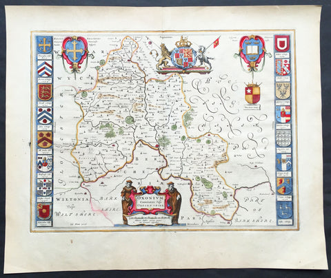
1647 Joan Blaeu Antique Map of the English County of Oxfordshire, Beautiful
- Title : Oxonium Comitatus, Vulgo Oxfordshire
-
Condition: (A+) Fine Condition
- Ref: 92846
- Size: 23 1/2in x 19 1/2in (600mm x 495mm)
- Date : 1647
Description:
This beautifully hand coloured original copper plate engraved antique map of the English county of Oxfordshire was published in the 1647 Dutch edition of Joan Blaeus Atlas Novus.
There is also the added bonus on the verso of the map with an early depiction of Stonehenge engraving to text.
Background:
This along with John Speeds map, is one of the most decorative of Oxfordshire. The basic cartographic information is derived from Speed's map, but presented with Blaeu typical elegance & decoration. These include coats-of-arms of the Oxford colleges along the sides, each expertly coloured, as well crests of nobility, the Royal coat-of-arms, and a title cartouche flanked by two Oxford scholars.
Blaeu is one of the most revered map makers of all time and it is easy to see why in this beautiful original map. The high level of the topographical detail, the quality of the paper, the artistic professionalism of the engraving and the beauty of the original hand colouring combine to produce a work of art that is both functional and of exceptional beauty. (Ref: Koeman; M&B)
General Description:
Paper thickness and quality: - Heavy and stable
Paper color: - off white
Age of map color: - Original
Colors used: - Yellow, pink, red, blue, green
General color appearance: - Authentic
Paper size: - 23 1/2in x 19 1/2in (600mm x 495mm)
Plate size: - 20in x 15 1/4in (510mm x 390mm)
Margins: - Min 1in (25mm)
Imperfections:
Margins: - None
Plate area: - None
Verso: - None
1692 Alexis Jaillot Large Antique Map of Great Britain & Ireland
- Title : Les Isles Britanniques; qui Contiennent les Royaumes d\'Angleterre, Escosse, et Irlande...Alexis Hubert Jaillot...1692
- Size: 34 1/2in x 22 1/2in (880m x 570mm)
- Condition: (B) Good Condition
- Date : 1692
- Ref #: 50658
Description:
This large, original hand coloured, antique map of the British Isles & Ireland by Alexis Hubert Jaillot - after Nicolas Sanson - was engraved in 1692 - the date is engraved in the scale cartouche.
There were three plates engraved for this highly prized map between the 1670s and early 1700s. This map is from the 2nd plate, state 4.
General Definitions:
Paper thickness and quality: - Heavy and stable
Paper color : - off white
Age of map color: - Original
Colors used: - Yellow, green, blue, pink
General color appearance: - Authentic
Paper size: - 34 1/2in x 22 1/2in (880m x 570mm)
Plate size: - 34 1/2in x 22 1/2in (880m x 570mm)
Margins: - Min 1/4in (4mm)
Imperfections:
Margins: - Bottom left corner and border restored. Margins cropped to plate-mark
Plate area: - Light offsetting & creasing.
Verso: - Several tears re-joined without loss
Background:
English Cartography: When considering the work of English map makers we tend, perhaps, to think too much in terms of county maps, dominated by the names of Saxton and Speed, but we should not underrate the contribution to the sum of geographical knowledge made in other spheres, such as the sea charts of Edward Wright, Robert Dudley and Greenvile Collins, the discoveries of James Cook, the road maps of Ogilby and Cary, the meteorological and magnetic charts compiled by Edmund Halley, to mention only a few.
In 1558 Queen Elizabeth came to the throne in the midst of a fast changing world. In 1563 a nineteen sheet map, copies of which survive only in manuscript form, was completed by Laurence Nowell, and no doubt, the issue of Mercator\'s large-scale map of the British Isles in 1564 had an important influence on the thought of the period. A few years later a national survey was commissioned privately, although probably at the instigation of Lord Burghley, the Lord Treasurer, but subsequently was completed with royal encouragement. The outcome was Christopher Saxton\'s Atlas of EngIand and Wales, started about 1570 and published in 1579 - the first printed set of county maps and the first countrywide atlas on such a splendid scale produced anywhere. A Welsh antiquarian, Humphrey Lhuyd completed a set of surveys that were even more successful than Saxton in which he had produced fine manuscript maps of England and Wales which were used by Ortelius in editions of his Atlas from 1573 onwards.
The earliest maps of the 17th century, attributed to William Smith of the College of Heralds, covered only twelve counties based on Saxton/Norden and were presumably intended to be part of a complete new atlas. They were printed in the Low Countries in 1602-3 and were soon followed by maps for the Latin edition of Camden\'s Britannia dated 1607. In 1610-11 the first edition of John Speed\'s famous county Atlas The Theatre of the Empire of Great Britaine was published and immediately replaced Saxton\'s in popular appeal. Although Speed assembled much of his material from the earlier works of Saxton, Norden and others, a considerable part of the up-to-date information, especially relating to the inset town plans depicted on his maps, was obtained first hand. The maps undoubtedly owed much of their popularity to the splendid engravings of high quality made in the workshops in Amsterdam of Jodocus Hondius to whom Speed sent his manuscripts, the plates subsequently being returned to London for printing.
In 1645, Volume IV of the famous Blaeu World Atlas covering the counties of England and Wales was published in Amsterdam. These maps have always been esteemed as superb examples of engraving and design, the calligraphy being particularly splendid, but nevertheless they were nearly all based on Saxton and Speed and added little to geographical knowledge.
Not until the latter part of the century do we find an English map maker of originality with the capacity to put new ideas into practice. John Ogilby, one of the more colourful figures associated with cartography, started life as a dancing master and finished as King\'s Cosmographer and Geographic Printer. After publishing a small number of county maps, somewhat on the lines of John Norden he issued in 1675 the Britannia, the first practical series of detailed maps of the post roads of England and Wales on a standard scale of 1,760 yards to the mile. Up to the end of the century and beyond, reprints and revisions of Saxton\'s and Speed\'s atlases continued to appear and the only other noteworthy county maps were Richard Blome\'s Britannia (1673), John Overton\'s Atlas (c. 1670) and Robert Morden\'s maps for an English translation of Camden\'s Britannia published in 1695.
Another noted cartographer of the day was Captain Greenvile Collins, and of his work in surveying the coasts of Great Britain culminating in the issue in 1693 of the Great Britain\'s Coasting Pilot. Apart from these charts, English cartographers published during the century a number of world atlases. Speed was the first Englishman to produce a world atlas with the issue in 1627 of his A Prospect of the Most Famous Parts of the World. Other atlases appeared later in the century by Peter Heylin, John Seller, William Berry, Moses Pitt and Richard Blome, whilst Ogilby found time to issue maps of Africa, America and Asia. Far more important, from the purely scientific point of view, was the work of Edmund Halley, Astronomer Royal, who compiled and issued meteorological and magnetic charts in 1688 and 1701 respectively.
At the beginning of the eighteenth century the Dutch map trade was finally in decline, the French in the ascendant and the English to a great extent still dominated by Saxton and Speed except, as we have shown, in the spheres of sea charts and road maps. There were atlases by John Senex, the Bowles family, Emanuel and Thomas Bowen, Thomas Badeslade and the unique bird\'s-eye perspective views of the counties, The British Monarchy by George Bickham. In 1750-60 Bowen and Kitchin\'s The Large English Atlas containing maps on a rather larger scale than hitherto was published.
In 1759 the Society for the encouragement of Arts, Manufactures and Commerce offered an award of £100 for the best original surveys on this scale and by the end of the century about thirty counties had been re-surveyed. These maps, many of which formed, in later years, the basis for the first issues of county maps by the Ordnance Survey Office were not only decorative but a tremendous improvement geographically on earlier local maps. As a consequence, the skills and expertise of the new-style cartographers soon enabled them to cover the world as well as the domestic market. Thomas Jefferys was such a man; he was responsible for a number of the new 1 in. to 1 mile county surveys and he issued an edition of Saxton\'s much battered 200-year-old plates of the county maps, but he is better known for many fine maps of North America and the West Indies. His work was continued on the same lines by William Faden, trading as Faden and Jefferys. Other publishers such as Sayer and Bennett and their successors Laurie and Whittle published a prodigious range of maps, charts and atlases in the second half of the century. A major influence at this time was John Cary who, apart from organizing the first re-survey of post roads since Ogilby and subsequently printing the noted Travellers\' Companion, was a prolific publisher of atlases and maps of every kind of all parts of the world. After starting work with Cary, and taking part in the new road survey, Aaron Arrowsmith set up in his own business and went on to issue splendid large-scale maps of many parts of the world. Both Cary\'s and Arrowsmith\'s plates were used by other publishers until far into the next century and, in turn, their work was taken up and developed by James Wyld (Elder and Younger) and Tallis and Co.
Later into the 19th century some of the better known cartographers and publishers were by Henry Teesdale (1829-30), Christopher and John Greenwood, surveyors, Thomas Moule, a writer on heraldry and antiques (1830-36) and John Walker (1837) but by about the middle of the century few small-scale publishers survived and their business passed into the hands of large commercial concerns such as Bartholomews of Edinburgh and Philips of London who continue to this day. (Ref: Shirley; Tooley; M&B)
1676 John Speed Antique County Map of MonmouthShire - Beautiful Original Colour
Antique Map
- Title : The Countye of Monmouth Anno 1610
- Date : 1676
- Size: 21in x 16in (535mm x 405mm)
- Condition: (A+) Fine Condition
- Ref: 35623
Description:
This original hand coloured copper plate engraved antique county map & views of Monmouth Shire and Monmouth City by John Speed was published in the 1676 Bassett & Chiswell edition of Speeds famous atlas The Theatre of the Empire of Great Britaine.
The map is embellished with the famous birds-eye views of the county and city with descriptive text on the verso.
General Definitions:
Paper thickness and quality: - Heavy and stable
Paper color : - off white
Age of map color: - Original
Colors used: - Yellow, green, blue, pink
General color appearance: - Authentic
Paper size: - 21in x 16in (535mm x 405mm)
Plate size: - 20 1/2in x 15 1/4in (520mm x 385mm)
Margins: - Min 1/2in (10mm)
Imperfections:
Margins: - Age toning
Plate area: - Age toning
Verso: - Age toning
Background:
John Speeds The Theatre of the Empire of Great Britaine was published in 1610/11 by John Sudbury and George Humble, and contained the first set of individual county maps of England and Wales besides maps of Ireland and a general map of Scotland. Most, but not all, of the county maps have town plans on them; those showing a Scale of Passes being the places he had mapped himself. The county maps were the first consistent attempt to show territorial divisions, such as boundaries of hundreds, but it was Speed’s town plans that were a major innovation and probably his greatest contribution to British cartography. The Theatre was an immediate success: the first print run of around 500 copies must have sold quickly because many editions followed. Sudbury and Humble realized, given the increasing popularity of both county and world atlases and in the light of the success of Abraham Ortelius’s Theatrum Orbis Terrarum, the potential demand for an English world atlas.
In 1627, two years before his death, Speed published Prospect of the Most Famous Parts of the World with 21 finely engraved maps, which was the first world atlas produced by an Englishman. There is a fascinating text describing the areas shown on the back of the maps in English, although a rare edition of 1616 of the British maps has a Latin text – this is believed to have been produced for the Continental market. Its maps are famous for their bordering panels of national characters in local costume and panoramic views depicting the areas of major towns and cities. Much of the engraving was done in Amsterdam at the workshop of Jodocus Hondius. The maps of the world and America show California as an island and are amongst the earliest ever printed to depict this seventeenth-century cartographic myth.
1610 John Speed Antique Map of The English County of Cambridgeshire
- Title : Cambridgeshire described with the deuision of the hundreds, the Townes situation with the Armes of the Colleges of that famous Vniuersiti...And also the Armes of all such Princes and noble men as have heertofore borne the Honorable tytles & dignities of the Earldome of Cambridge....Performed by John Speede and are to be sold in popes alley by John Sudbury and G Humbell...Cum Privilego 1610.
- Size: 20 1/2in x 15in (510mm x 380mm)
- Condition: (B) Good Condition
- Date : 1610
- Ref #: 80002
Description:
This original hand coloured antique 1st edition map of the English county of Cambridgeshire was engraved in 1610 - dated -and was published by John Sudbury & George Humble in the 1612 1st edition of John Speeds famous atlas The Theatre of the Empire of Great Britaine.
The map has some loss mainly along the borders and a few small areas below both sets of figures. Map has been mounted onto an original index page fro m Speeds atlas.
General Definitions:
Paper thickness and quality: - Heavy and stable
Paper color : - off white
Age of map color: - Original
Colors used: - Yellow, green, blue, pink
General color appearance: - Authentic
Paper size: - 20 1/2in x 15in (510mm x 380mm)
Plate size: - 20 1/2in x 15in (510mm x 380mm)
Margins: - Min 1/2in (12mm)
Imperfections:
Margins: - Map cropped to and into borders
Plate area: - Small loss below both sets of figures at the bottom of the map
Verso: - Backed onto original Speed index double page
Background:
Strong reference is made to Cambridges famous and renowned university with the (twenty five) armourials of the colleges and four scholarly figures. The birds eye view plan of Cambridge city is based on the one done by John Hammond in 1592.
1692 Jaillot Large Antique Map Sea Chart The English Channel during 9 Years War
- Title : Carte De La Manche faite par ordre du Roy. pour le Service de les Armees de Mer.....a Paris...1692
- Size: 38in x 25in (960m x 635mm)
- Condition: (A+) Fine Condition
- Date : 1692
- Ref #: 16371
Description:
This very large, beautifully hand coloured original copper-plate engraved antique map, a large Sea Chart of The English Channel - produced for the French Navy during the Nine Years War and specifically the Battle of Beachy Head - was engraved in 1692, dated in the cartouche, and was published for Alexis Hubert Jaillots 1698 edition of his monumental Atlas Nouveau.
General Definitions:
Paper thickness and quality: - Heavy and stable
Paper color : - off white
Age of map color: - Original
Colors used: - Yellow, pink, green, blue
General color appearance: - Authentic
Paper size: - 38in x 25in (960m x 635mm)
Plate size: - 32 1/2in x 23 1/2in (825mm x 595mm)
Margins: - Min 1in (25mm)
Imperfections:
Margins: - None
Plate area: - None
Verso: - None
Background:
The Nine Years War (1688–97)—often called the War of the Grand Alliance or the War of the League of Augsburg—was a conflict between Louis XIV of France and a European coalition of the Holy Roman Empire, led by Austria, the Dutch Republic, Spain, England and Savoy. It was fought in Europe and the surrounding seas, North America and in India. It is sometimes considered the first global war. The conflict encompassed the Williamite war in Ireland and Jacobite risings in Scotland, where William III and James II struggled for control of England and Ireland, and a campaign in colonial North America between French and English settlers and their respective Indigenous allies, today called King Williams War by Americans.
Louis XIV of France had emerged from the Franco-Dutch War in 1678 as the most powerful monarch in Europe, an absolute ruler who had won numerous military victories. Using a combination of aggression, annexation, and quasi-legal means, Louis XIV set about extending his gains to stabilize and strengthen France\'s frontiers, culminating in the brief War of the Reunions (1683–84). The Truce of Ratisbon guaranteed France\'s new borders for twenty years, but Louis XIV\'s subsequent actions—notably his Edict of Fontainebleau (the revocation of the Edict of Nantes) in 1685— led to the deterioration of his military and political dominance. Louis XIVs decision to cross the Rhine in September 1688 was designed to extend his influence and pressure the Holy Roman Empire into accepting his territorial and dynastic claims. Leopold I and the German princes resolved to resist, and when the States General and William III brought the Dutch and the English into the war against France, the French King faced a powerful coalition aimed at curtailing his ambitions.
The main fighting took place around Frances borders in the Spanish Netherlands, the Rhineland, the Duchy of Savoy and Catalonia. The fighting generally favoured Louis XIV\'s armies, but by 1696 his country was in the grip of an economic crisis. The Maritime Powers (England and the Dutch Republic) were also financially exhausted, and when Savoy defected from the Alliance, all parties were keen to negotiate a settlement. By the terms of the Treaty of Ryswick (1697) Louis XIV retained the whole of Alsace but was forced to return Lorraine to its ruler and give up any gains on the right bank of the Rhine. Louis XIV also accepted William III as the rightful King of England, while the Dutch acquired a Barrier fortress system in the Spanish Netherlands to help secure their borders. With the ailing and childless Charles II of Spain approaching his end, a new conflict over the inheritance of the Spanish Empire embroiled Louis XIV and the Grand Alliance in the War of the Spanish Succession.
The Battle of Beachy Head (Bévéziers) was a naval engagement fought on 10 July 1690 during the Nine Years\' War. The battle was the greatest French tactical naval victory over their English and Dutch opponents during the war. The Dutch lost six ships of the line (sources vary) and three fireships; their English allies also lost one ship of the line, whereas the French did not lose a vessel. Control of the English Channel temporarily fell into French hands but Vice-Admiral Tourville failed to pursue the Allied fleet with sufficient vigour, allowing it to escape to the River Thames.
Tourville was criticised for not following up his victory and was relieved of his command. The English Admiral Arthur Herbert, 1st Earl of Torrington – who had advised against engaging the superior French fleet but had been overruled by Queen Mary and her ministers – was court-martialled for his performance during the battle. Although he was acquitted, King William dismissed him from the service.
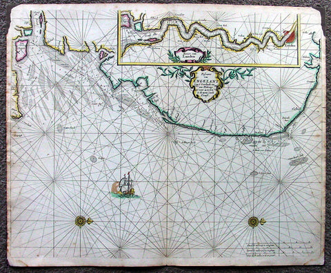
1676 Pieter Goos Large Antique Map of England, Thames River, London
- Title : Pascaarte van Engelant van t' Voorlandt tot aen Blakeney waer in te Sien is de Mont vande Teemse
- Date : 1676
- Condition: (A) Very Good Condition
- Ref: 42012
- Size: 22in x 18in (560mm x 455mm)
Description:
This large, beautifully hand coloured original antique map, a fine early Dutch sea chart of the Thames River and surrounding English coastline, was published by Pieter Goos in 1676 for the Goos De Zee-Atlas, Ofte Water-Weereld, Atlas.
This chart is oriented with north to the right includes in the upper right is a large inset of the Thames River and plan of London. Beautifully engraved with original coulouring embellished with rhumb lines, two compass roses and a galleon under sail. (Ref: Tooley; M&B; Koeman)
General Description:
Paper thickness and quality: - Heavy and stable
Paper color: - off white
Age of map color: - Original
Colors used: - Yellow, green, red, rose madder, red
General color appearance: - Authentic and fresh
Paper size: - 22in x 18in (560mm x 455mm)
Plate size: - 22in x 18in (560mm x 455mm)
Margins: - Min ½in (12mm)
Imperfections:
Margins: - Top L&R margin corner ink spill not affecting image
Plate area: - None
Verso: - Light soiling
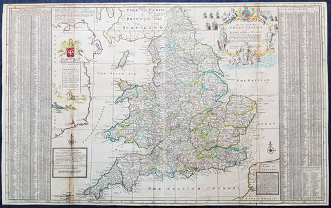
1710 Herman Moll Large Antique Map of England & Wales - extensive Details
- Title : The South Part of Great Britain called England & Wales...by Herman Moll 1710
- Size: 39in x 24in (1.0m x 610mm)
- Condition: (A) Very Good Condition
- Date : 1710
- Ref #: 80662
Description:
This large beautifully hand coloured original copper-plate engraved antique map of England & Wales was engraved in 1710 by Herman Moll - the date is engraved in the title cartouche - and was published by John Bowles of London.
Striking large format, one off published, map of England and Wales. The map is embellished with two large cartouches and an extensive table locating all ye Cities, Market Towns, Boroughs and whateve Places in South Britain have ye Election of Members of Parliament.
The map is elaborately colored by counties, with 5 sailing ships to the right of Northumberland. Includes a dedication to Right Honourable FRANCIS, Lord Viscount Rialton in the cartouche at the right side of the map.
General Definitions:
Paper thickness and quality: - Heavy and stable
Paper color : - off white
Age of map color: - Original
Colors used: - Yellow, green, blue, pink
General color appearance: - Authentic
Paper size: - 39in x 24in (1.0m x 610mm)
Plate size: - 38in x 23in (970mm x 585mm)
Margins: - Min 1/2in (12mm)
Imperfections:
Margins: - None
Plate area: - Light age toning along folds
Verso: - None
Background:
English Cartography: When considering the work of English map makers we tend, perhaps, to think too much in terms of county maps, dominated by the names of Saxton and Speed, but we should not underrate the contribution to the sum of geographical knowledge made in other spheres, such as the sea charts of Edward Wright, Robert Dudley and Greenvile Collins, the discoveries of James Cook, the road maps of Ogilby and Cary, the meteorological and magnetic charts compiled by Edmund Halley, to mention only a few.
In 1558 Queen Elizabeth came to the throne in the midst of a fast changing world. In 1563 a nineteen sheet map, copies of which survive only in manuscript form, was completed by Laurence Nowell, and no doubt, the issue of Mercators large-scale map of the British Isles in 1564 had an important influence on the thought of the period. A few years later a national survey was commissioned privately, although probably at the instigation of Lord Burghley, the Lord Treasurer, but subsequently was completed with royal encouragement. The outcome was Christopher Saxtons Atlas of EngIand and Wales, started about 1570 and published in 1579 - the first printed set of county maps and the first countrywide atlas on such a splendid scale produced anywhere. A Welsh antiquarian, Humphrey Lhuyd completed a set of surveys that were even more successful than Saxton in which he had produced fine manuscript maps of England and Wales which were used by Ortelius in editions of his Atlas from 1573 onwards.
The earliest maps of the 17th century, attributed to William Smith of the College of Heralds, covered only twelve counties based on Saxton/Norden and were presumably intended to be part of a complete new atlas. They were printed in the Low Countries in 1602-3 and were soon followed by maps for the Latin edition of Camdens Britannia dated 1607. In 1610-11 the first edition of John Speeds famous county Atlas The Theatre of the Empire of Great Britaine was published and immediately replaced Saxtons in popular appeal. Although Speed assembled much of his material from the earlier works of Saxton, Norden and others, a considerable part of the up-to-date information, especially relating to the inset town plans depicted on his maps, was obtained first hand. The maps undoubtedly owed much of their popularity to the splendid engravings of high quality made in the workshops in Amsterdam of Jodocus Hondius to whom Speed sent his manuscripts, the plates subsequently being returned to London for printing.
In 1645, Volume IV of the famous Blaeu World Atlas covering the counties of England and Wales was published in Amsterdam. These maps have always been esteemed as superb examples of engraving and design, the calligraphy being particularly splendid, but nevertheless they were nearly all based on Saxton and Speed and added little to geographical knowledge.
Not until the latter part of the century do we find an English map maker of originality with the capacity to put new ideas into practice. John Ogilby, one of the more colourful figures associated with cartography, started life as a dancing master and finished as Kings Cosmographer and Geographic Printer. After publishing a small number of county maps, somewhat on the lines of John Norden he issued in 1675 the Britannia, the first practical series of detailed maps of the post roads of England and Wales on a standard scale of 1,760 yards to the mile. Up to the end of the century and beyond, reprints and revisions of Saxtons and Speeds atlases continued to appear and the only other noteworthy county maps were Richard Blomes Britannia (1673), John Overtons Atlas (c. 1670) and Robert Mordens maps for an English translation of Camdens Britannia published in 1695.
Another noted cartographer of the day was Captain Greenvile Collins, and of his work in surveying the coasts of Great Britain culminating in the issue in 1693 of the Great Britains Coasting Pilot. Apart from these charts, English cartographers published during the century a number of world atlases. Speed was the first Englishman to produce a world atlas with the issue in 1627 of his A Prospect of the Most Famous Parts of the World. Other atlases appeared later in the century by Peter Heylin, John Seller, William Berry, Moses Pitt and Richard Blome, whilst Ogilby found time to issue maps of Africa, America and Asia. Far more important, from the purely scientific point of view, was the work of Edmund Halley, Astronomer Royal, who compiled and issued meteorological and magnetic charts in 1688 and 1701 respectively.
At the beginning of the eighteenth century the Dutch map trade was finally in decline, the French in the ascendant and the English to a great extent still dominated by Saxton and Speed except, as we have shown, in the spheres of sea charts and road maps. There were atlases by John Senex, the Bowles family, Emanuel and Thomas Bowen, Thomas Badeslade and the unique birds-eye perspective views of the counties, The British Monarchy by George Bickham. In 1750-60 Bowen and Kitchins The Large English Atlas containing maps on a rather larger scale than hitherto was published.
In 1759 the Society for the encouragement of Arts, Manufactures and Commerce offered an award of £100 for the best original surveys on this scale and by the end of the century about thirty counties had been re-surveyed. These maps, many of which formed, in later years, the basis for the first issues of county maps by the Ordnance Survey Office were not only decorative but a tremendous improvement geographically on earlier local maps. As a consequence, the skills and expertise of the new-style cartographers soon enabled them to cover the world as well as the domestic market. Thomas Jefferys was such a man; he was responsible for a number of the new 1 in. to 1 mile county surveys and he issued an edition of Saxtons much battered 200-year-old plates of the county maps, but he is better known for many fine maps of North America and the West Indies. His work was continued on the same lines by William Faden, trading as Faden and Jefferys. Other publishers such as Sayer and Bennett and their successors Laurie and Whittle published a prodigious range of maps, charts and atlases in the second half of the century. A major influence at this time was John Cary who, apart from organizing the first re-survey of post roads since Ogilby and subsequently printing the noted Travellers Companion, was a prolific publisher of atlases and maps of every kind of all parts of the world. After starting work with Cary, and taking part in the new road survey, Aaron Arrowsmith set up in his own business and went on to issue splendid large-scale maps of many parts of the world. Both Carys and Arrowsmiths plates were used by other publishers until far into the next century and, in turn, their work was taken up and developed by James Wyld (Elder and Younger) and Tallis and Co.
Later into the 19th century some of the better known cartographers and publishers were by Henry Teesdale (1829-30), Christopher and John Greenwood, surveyors, Thomas Moule, a writer on heraldry and antiques (1830-36) and John Walker (1837) but by about the middle of the century few small-scale publishers survived and their business passed into the hands of large commercial concerns such as Bartholomews of Edinburgh and Philips of London who continue to this day. (Ref: Shirley; Tooley; M&B)
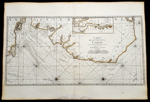
1693 A H Jaillot Large Sea Chart, Map of SE England and Thames Estuary, Clay to Sandwich
- Title : Carte de l entree de la Tamise avec les bancs, passes, isles et costes comprises entre Sandwich et Clay. (Map of the Thames estuary entry with the banks, streets, islands and coasts between Sandwich and Clay)
- Size: 37 1/2in x 25 1/2in (950mm x 650mm)
- Condition: (A+) Fine Condition
- Date : 1693
- Ref #: 93356
Description:
This large beautifully hand coloured original 1693 antique sea-chart, map of SE England from Clay, Norfolk, to Sandwich and the entrance of the Thames Estuary by A H Jaillot was published in his large elephant folio Le Neptune Francois, ou Atlas Nouveau des Cartes Marines
Handsome sea-chart illustrating the importance of this region to Englands dominance by its navy. Shows the Thames Estuary & river to London, showing many sandbars, soundings and coastline, blank verso.
General Definitions:
Paper thickness and quality: - Heavy and stable
Paper color : - off white
Age of map color: - Original
Colors used: - Yellow
General color appearance: - Authentic
Paper size: - 37 1/2in x 25 1/2in (950mm x 650mm)
Plate size: - 36in x 18in (930mm x 460mm)
Margins: - Min 1in (25mm)
Imperfections:
Margins: - Light age toning
Plate area: - None
Verso: - None
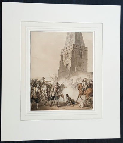
1810 John Augustus Atkinson Original Water Colour Art of an English War Skirmish
- Title : (A Civil War Skirmish)
- Ref #: 93444
- Size: 17in x 15in (430mm x 365mm)
- Date : 1810
- Condition: (A+) Fine Condition
Description:
This beautifully executed original pen, pencil and watercolour picture of an English Civil War battle scene was painted by John Augustus Atkinson in ca 1810.
Atkinson was known for his battle scene art works during his time at the St Petersburg Court in Russia as well as his Napoleonic battle scenes from the early 19th century.
Atkinson is held in high esteem as a watercolourist, and was elected as a member of the Society of Painters in Water Colours in 1808. He has works of art held at many prestigious museums in Russia, Europe and the UK, such as the Tate, Royal Watercolour Society, National Maritime Museum and many more listed below. He also sells on the open market with this piece last sold in 2004.
Professionally matted and can be easily removed if required.
General Definitions:
Paper thickness and quality: - Heavy and stable
Paper color : - off white
Age of map color: - Original
Colors used: - Blue, pink, red, green, yellow
General color appearance: - Authentic
Paper size: - 17in x 15in (430mm x 365mm)
Plate size: - 9 3/4in x 8in (247mm x 203mm)
Margins: - Min 0in (0mm)
Imperfections:
Margins: - None
Plate area: - None
Verso: - None
Background:
The English Civil War (1642–1651) was a series of civil wars and political machinations between Parliamentarians (Roundheads) and Royalists (Cavaliers) principally over the manner of Englands governance and part of the wider Wars of the Three Kingdoms. The first (1642–1646) and second (1648–1649) wars pitted the supporters of King Charles I against the supporters of the Long Parliament, while the third (1649–1651) saw fighting between supporters of King Charles II and supporters of the Rump Parliament. The war ended with Parliamentarian victory at the Battle of Worcester on 3 September 1651.
Unlike other civil wars in England, which were mainly fought over who should rule, these conflicts were also concerned with how the three kingdoms of England, Scotland, and Ireland were to be governed. The outcome was threefold: the trial and execution of Charles I (1649); the exile of his son, Charles II (1651); and the replacement of English monarchy with, at first, the Commonwealth of England (1649–1653) and then the Protectorate, which as the Commonwealth of England, Scotland, and Ireland unified the British Isles under the personal rule of Oliver Cromwell (1653–1658) and briefly his son Richard (1658–1659). The execution of Charles I was particularly notable given that an English king had never been executed before. In England, the monopoly of the Church of England on Christian worship was ended, while in Ireland the victors consolidated the established Protestant Ascendancy. Constitutionally, the wars established the precedent that an English monarch cannot govern without Parliaments consent, although the idea of Parliamentary sovereignty was only legally established as part of the Glorious Revolution in 1688.
Atkinson, John Augustus 1775 - 1830
Atkinson was an English artist, engraver and watercolourist.
He was born in London and at the age of 9, in 1784, went to live with his uncle, the famous engraver James Walker, in St Petersburg, Russia. Walker was engraver to the empress Catherine the Great 1729 - 1796 and encouraged Atkinson to study art, seeing a talent in him. Atkinson was well placed in St Petersburg to study art, being surrounded by the many collections of Catherine and the Russian Nobility, the richest in Europe. It is known that Atkinson was encouraged by Catherine herself along with and her son & later Emperor of Russia Paul I 1754 - 1801. Paul later commissioned Atkinson to paint large pieces from Russian history that can be seen in many Museums today around the world.
After the death of Paul in 1801, Atkinson returned to England and in 1803 published A Picturesque Representation of the Manners, Customs, and Amusements of the Russians, in 100 plates, drawn and etched by himself. He also painted in watercolours and in 1808 was elected to the Society of Painters in Water Colours. Many of his works, during the Napoleonic wars, were of naval subjects. He painted many battle scenes including a Battle of Waterloo, which was engraved by John Burnet.
His last contribution to the Royal Academy exhibition was in 1829. He died on 25 March 1830 in London.
Selected Works
• Carriage on Sledges 1803 Art Gallery of Greater Victoria, British Columbia
• A Russian Village 1804 Art Gallery of Greater Victoria, British Columbia
• Golubtza 1804 Art Gallery of Greater Victoria, British Columbia
• Village Amusements 1804 Art Gallery of Greater Victoria, British Columbia
• Scene from Tom Jones Courtauld Institute of Art, London
• The Slack Rope Courtauld Institute of Art, London
• A Belgian Waggon with Four Horses Tate Gallery, London
• Illustrations to Ossian The Huntington Library, California
• Heaving a Lead 1807 National Maritime Museum
• Greenwich Pensioners 1808 National Maritime Museum
• Skating, 1810 Tyne & Wear Museums, England
• Ships of the Reign of King Edward IV 1812 - Fine Arts Museums of San Francisco
• 42nd Highlanders at Waterloo Courtauld Institute of Art, London
• British Sailors Boarding a Man of War 1815 National Maritime Museum
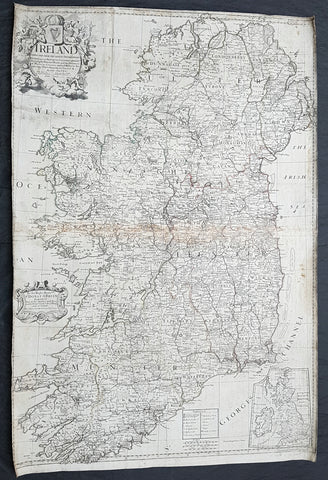
1712 John Senex Large Original Antique Map of Ireland
- Title : Ireland Corrected from the Latest Observations....by John Senex FRS....London 1712
- Size: 38 1/2in x 26in (980mm x 660mm)
- Condition: (B) Good Condition
- Date : 1712
- Ref #: 22573
Description:
This large original copper plate engraved antique map of Ireland by John Senex, was engraved in 1712 - dated - as a large stand alone map.
These large scale maps are scarce due mainly to their size, with damage and loss over time inevitable.
General Definitions:
Paper thickness and quality: - Heavy and stable
Paper color : - off white
Age of map color: -
Colors used: -
General color appearance: -
Paper size: - 38 1/2in x 26in (980mm x 660mm)
Plate size: - 38 1/2in x 26in (980mm x 660mm)
Margins: - Min 1in (25mm)
Imperfections:
Margins: - Soiling and chipping to margins, cropped to border
Plate area: - Light soiling, light browning along centerfold
Verso: - Original canvas backing
Background:
The earliest maps of Ireland up to the year 1500 or so share the shortcomings of those of the rest of the British Isles especially as represented on world maps. It was not to be expected that lands literally on the very edge of the known world could be depicted with any accuracy; very often one feels that the cartographers or engravers placed the islands in the nearest available space consistent with their imagined position. Even in the first printed Ptolemaic map there is still much distortion in Ireland\\\'s shape and geographical position but, on the other hand, a quite surprising number of place names and other details are shown, as many, in fact, as in the rest of Britain put together. This detailed knowledge is not as puzzling as it might appear, for the Ptolemy maps, at least the later editions from 1513 onwards, were based on Italian portulan charts and these, in turn, reflected knowledge gained during the long commercial relationship which had existed between Italy and Ireland ever since the thirteenth century. The distortions on land-surveyed maps remained uncorrected until late in the seventeenth century but a quite accurate coastal outline was given in the marine atlases of Waghenaer, Dudley, Blaeu and later Dutch chart makers.
Apart from a few manuscript maps and very rare maps printed in Rome and Venice (George Lily, 1546, and others in the period 1560-66) Ireland is shown on Mercator\\\'s large map of the British Isles (1564), and in his Atlas (1595) and as a separate sheet in the Ortelius atlases (from 1 573). The most important map, however, was compiled by an Italian, Baptista Boazio, probably in the 1 5 8os. This has survived in manuscript form and may have been used by Pieter van der Keere for a map published by Jodocus Hondius in 1591. Boazio\\\'s map was subsequently published by John Sudbury, who later sold Speed\\\'s maps, and this version was included in editions of the Ortelius atlases from 6oz onwards. The Boazio map is a quite splendid map, very decorative, some copies even showing an Eskimo complete with kayak and hunting spear. Thereafter the trend is familiar: Camden, Speed, Blaeu, Jansson, Sanson and others of the Dutch and French schools all included a general map or maps of the Irish provinces in their atlases. Speed\\\'s map of the whole of Ireland was based at least partly on surveys by Robert Lythe (c.1570) and Francis Jobson (c.1590) and included figures in national costume; it was for long regarded as the best map available and was much copied by publishers in other countries.
In 1685 the first atlas of Ireland to match Saxton\\\'s At/as of Eng/andand Wales was published by Sir William Petty as Hiberniae Detineaho, the result of a highly organized and detailed survey (the \\\'Down\\\' survey) carried out in the years following 1655. Re-issued in miniature form soon afterwards by Francis Lamb, Petty\\\'s Atlas was widely used as the basis for practically all maps of Ireland produced by English, French, Dutch and German publishers in the following century. Apart from re-issues of Petty\\\'s Atlas and its many copyists there were maps by George Grierson, a Dublin publisher, John Rocque, the Huguenot surveyor and engraver who spent some years in Dublin, and Bernard Scale, Rocque\\\'s brother-in-law.
Towards the end of the century many large-scale maps were published but, as in England, private mapping was gradually overtaken and eventually replaced by the Ordnance Survey maps produced between the years 1824 and 1846.(Ref: Koeman, Tooley)
1719 Henri Chatelain Large Antique Map of London, England & 2 Allegorical Views
- Title : Plan de la Ville De Londres et Diversee Remarques Sur Ceite Ville
- Ref #: 93423
- Size: 21 1/2in x 17in (545mm x 435mm)
- Date : 1719
- Condition: (A+) Fine Condition
Description:
This large beautifully hand coloured original copper plate engraved antique map of London, England with two large allegorical views, was published by Henri Abraham Chatelain in 1719, in his famous Atlas Historique.
General Definitions:
Paper thickness and quality: - Heavy and stable
Paper color : - off white
Age of map color: - Early
Colors used: - Yellow, green, blue, pink
General color appearance: - Authentic
Paper size: - 21 1/2in x 17in (545mm x 435mm)
Plate size: - 18 1/2in x 14in (470mm x 355mm)
Margins: - Min 1in (25mm)
Imperfections:
Margins: - None
Plate area: - None
Verso: - None
Background:
The 18th century was a period of rapid growth for London, reflecting an increasing national population, the early stirrings of the Industrial Revolution, and Londons role at the centre of the evolving British Empire.
In 1707, an Act of Union was passed merging the Scottish and the English Parliaments, thus establishing the Kingdom of Great Britain. A year later, in 1708 Christopher Wrens masterpiece, St Pauls Cathedral was completed on his birthday. However, the first service had been held on 2 December 1697; more than 10 years earlier. This Cathedral replaced the original St. Pauls which had been completely destroyed in the Great Fire of London. This building is considered one of the finest in Britain and a fine example of Baroque architecture.
Many tradesmen from different countries came to London to trade goods and merchandise. Also, more immigrants moved to London making the population greater. More people also moved to London for work and for business making London an altogether bigger and busier city. Britains victory in the Seven Years War increased the countrys international standing and opened large new markets to British trade, further boosting Londons prosperity.
During the Georgian period London spread beyond its traditional limits at an accelerating pace. This is shown in a series of detailed maps, particularly John Rocques 1741–45 map (see below) and his 1746 Map of London. New districts such as Mayfair were built for the rich in the West End, new bridges over the Thames encouraged an acceleration of development in South London and in the East End, the Port of London expanded downstream from the City. During this period was also the uprising of the American colonies. In 1780, the Tower of London held its only American prisoner, former President of the Continental Congress, Henry Laurens. In 1779, he was the Congresss representative of Holland, and got the countrys support for the Revolution. On his return voyage back to America, the Royal Navy captured him and charged him with treason after finding evidence of a reason of war between Great Britain and the Netherlands. He was released from the Tower on 21 December 1781 in exchange for General Lord Cornwallis.
In 1762, George III acquired Buckingham Palace (then called Buckingham House) from the Duke of Buckingham. It was enlarged over the next 75 years by architects such as John Nash.
A phenomenon of the era was the coffeehouse, which became a popular place to debate ideas. Growing literacy and the development of the printing press meant that news became widely available. Fleet Street became the centre of the embryonic national press during the century.
18th-century London was dogged by crime. The Bow Street Runners were established in 1750 as a professional police force. Penalties for crime were harsh, with the death penalty being applied for fairly minor crimes. Public hangings were common in London, and were popular public events.
In 1780, London was rocked by the Gordon Riots, an uprising by Protestants against Roman Catholic emancipation led by Lord George Gordon. Severe damage was caused to Catholic churches and homes, and 285 rioters were killed.
In the year 1787, freed slaves from London, America, and many of Britains colonies founded Freetown in modern-day Sierra Leone.
Up until 1750, London Bridge was the only crossing over the Thames, but in that year Westminster Bridge was opened and, for the first time in history, London Bridge, in a sense, had a rival. In 1798, Frankfurt banker Nathan Mayer Rothschild arrived in London and set up a banking house in the city, with a large sum of money given to him by his father, Amschel Mayer Rothschild. The Rothschilds also had banks in Paris and Vienna. The bank financed numerous large-scale projects, especially regarding railways around the world and the Suez Canal.
The 18th century saw the breakaway of the American colonies and many other unfortunate events in London, but also great change and Enlightenment. This all led into the beginning of modern times, the 19th century.
1757 Bellin Large Antique Map of Scotland, Orkneys, Shetlands, Lewis & Harris
- Title : Carte Reduite des Isles Britanniques Quatrieme Feuille Partie Septentrionale de l Ecosse. 1757
- Size: 37 1/2in x 25 1/2in (950mm x 650mm)
- Condition: (A+) Fine Condition
- Date : 1757
- Ref #: 35501
Description:
This very large finely engraved original copper-plate engraved antique map, Sea Chart, of northern Scotland, Orkney & Shetland Islands, Lewis & Harris - along with relief inset of Orkneys - by Jacques Nicolas Bellin in 1757 - dated in the title cartouche.
General Definitions:
Paper thickness and quality: - Heavy and stable
Paper color : - off white
Age of map color: -
Colors used: -
General color appearance: -
Paper size: - 37 1/2in x 25 1/2in (950mm x 650mm)
Plate size: - 35 1/2in x 24in (900mm x 580mm)
Margins: - Min 1in (25mm)
Imperfections:
Margins: - None
Plate area: - None
Verso: - None
Background:
In the 14th century, Orkney and Shetland remained a Norwegian possession, but Scottish influence was growing. Jon Haraldsson, who was murdered in Thurso in 1231, was the last of an unbroken line of Norse jarls, and thereafter the earls were Scots noblemen of the houses of Angus and St Clair. On the death of Haakon VI in 1380, Norway formed a political union with Denmark, after which the interest of the royal house in the islands declined. In 1469, Shetland was pledged by Christian I, in his capacity as King of Norway, as security against the payment of the dowry of his daughter Margaret, betrothed to James III of Scotland. As the money was never paid, the connection with the Crown of Scotland became permanent. In 1470, William Sinclair, 1st Earl of Caithness ceded his title to James III, and the following year the Northern Isles were directly annexed to the Crown of Scotland, an action confirmed by the Parliament of Scotland in 1472. Nonetheless, Shetlands connection with Norway has proved to be enduring.
From the early 15th century on the Shetlanders sold their goods through the Hanseatic League of German merchantmen. The Hansa would buy shiploads of salted fish, wool and butter, and import salt, cloth, beer and other goods. The late 16th century and early 17th century were dominated by the influence of the despotic Robert Stewart, Earl of Orkney, who was granted the islands by his half-sister Mary Queen of Scots, and his son Patrick. The latter commenced the building of Scalloway Castle, but after his imprisonment in 1609 the Crown annexed Orkney and Shetland again until 1643 when Charles I granted them to William Douglas, 7th Earl of Morton. These rights were held on and off by the Mortons until 1766, when they were sold by James Douglas, 14th Earl of Morton to Laurence Dundas.
The trade with the North German towns lasted until the 1707 Act of Union, when high salt duties prevented the German merchants from trading with Shetland. Shetland then went into an economic depression, as the local traders were not as skilled in trading salted fish. However, some local merchant-lairds took up where the German merchants had left off, and fitted out their own ships to export fish from Shetland to the Continent. For the independent farmers of Shetland this had negative consequences, as they now had to fish for these merchant-lairds.
Smallpox afflicted the islands in the 17th and 18th centuries (as it did all of Europe), but as vaccines became available after 1800, health improved. The island was very badly hit by the potato famine of 1846 and the government introduced a Relief Plan for the island under the command of Captain Robert Craigie of the Royal Navy who stayed in Lerwick to oversee the project 1847-1852. During this period Craigie also did much to improve and increase roads on the island.
Population increased to a maximum of 31,670 in 1861. However, British rule came at price for many ordinary people as well as traders. The Shetlanders nautical skills were sought by the Royal Navy. Some 3,000 served during the Napoleonic wars from 1800 to 1815 and press gangs were rife. During this period 120 men were taken from Fetlar alone, and only 20 of them returned home. By the late 19th century 90% of all Shetland was owned by just 32 people, and between 1861 and 1881 more than 8,000 Shetlanders emigrated. With the passing of the Crofters Act in 1886 the Liberal prime minister William Gladstone emancipated crofters from the rule of the landlords. The Act enabled those who had effectively been landowners serfs to become owner-occupiers of their own small farms. By this time fishermen from Holland, who had traditionally gathered each year off the coast of Shetland to fish for herring, triggered an industry in the islands that boomed from around 1880 until the 1920s when stocks of the fish began to dwindle. The production peaked in 1905 at more than a million barrels, of which 708,000 were exported
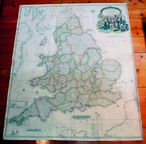
1761 John Rocque & Robert Sayer Very Large Antique Map of England & Wales
- Title : England and Wales Drawn from the Most Accurate Surveys...by John Rocque
- Date : 1761
- Condition: (A) Very Good Condition
- Ref: 92242
- Size: 49in x 37in (1.25m x 1.00m)
Description:
This very large - 4 sheet joined - famous mid 18th century original antique map of England and Wales by John Rocque was published by Robert Sayer in the large 1761 edition of A General Atlas Describing the Whole Universe.
This map is extremely detailed denoting nearly every town river canal and point of interest. This type of cartography is indicative of the British attention to detail & research that helped Britain become the world power over the next 150 years.
John Rocque c. 1704-62 - Little is known of John Rocque's early life except that he was of Huguenot extraction and was living and working in London as an engraver from about 1734. His early experience in preparing plans of great houses and gardens for the nobility led him to take up large-scale surveying for which he developed a distinctive and effective style involving new ways of indicating land use and hill contours. He is best known for a very large-scale plan of London published in 1746 and for a pocket set of county maps, The English Traveller, issued in the same year. He spent some years in Ireland surveying for estate maps and in 1756 he published a well-known Exact Survey of the City of Dublin.
Rocque was Topographer to the Prince of Wales and attained his new title after the coronation in 1760. He flourished from 1734-62. Sayer, a famous and prolific mapmaker, was taken into partnership by John Overton in 1745. After his death in 1752 Sayer continued on his own forming several associations until his own death in 1792. His association with Rocque began in 1753. (Ref:M&B; Tooley)
General Description:
Paper thickness and quality: - Heavy & stable
Paper color: - White
Age of map color: - Original & later
Colors used: - Blue, brown
General color appearance: - Authentic
Paper size: - 49in x 37in (1.25m x 1.00m)
Paper size: - 49in x 37in (1.25m x 1.00m)
Margins: - Min 1/2in (12mm)
Imperfections:
Margins: - Several folds re-enforced and re-joined
Plate area: - Folds as issued, light offsetting, several folds re-enforced and re-joined
Verso: - Several folds re-enforced and re-joined
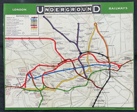
1908 UERL Johnson & Riddle Antique London Underground Map Rare 2nd Map Published
- Title : London Underground Railways
- Ref #: 17054
- Size: 13 3/4in x 11 1/2in (352mm x 290mm)
- Date : 1908
- Condition: (A+) Fine Condition
Description:
This original early scarce antique folding, pocket map of The London Underground, only the second combined map, by The Underground Electric Railways Company of London (UERL) was published by Johnson, Riddle & co. in 1908.
The first map was published a year earlier by The Evening News in 1907.
This geographic paper edition of the Underground map shows the Railway lines belonging to the Underground Group as well as the Central London Railway and Metropolitan Railway lines. Each line is represented by a different colour, other railways are marked with lighter black lines, London United tramways are shown by lines of crosses and other tramways routes are marked with a broken line. General geographic features such as roads and parks are also included. Earl's Court Exhibition Ground is marked on this map as well as the Franco-British Exhibition at Shepherd's Bush. This map has a green border and the UndergrounD logo is used in the map title.
General Definitions:
Paper thickness and quality: - Heavy and stable
Paper color : - off white
Age of map color: - Original
Colors used: - Yellow, green, blue, pink
General color appearance: - Authentic
Paper size: - 13 3/4in x 11 1/2in (352mm x 290mm)
Plate size: - 13 3/4in x 11 1/2in (352mm x 290mm)
Margins: - Min 1/8in (2mm)
Imperfections:
Margins: - Folds as issued
Plate area: - Folds as issued
Verso: - Folds as issued
Background:
As Londons early transport system was operated by a variety of independent companies, there were no complete maps of the network, just for the individual companies routes. The maps were not typically schematic and were simply the line overlaid on a regular city map. There was no integration of the companies services or any co-operation in advertising.
In 1907, The Evening News commissioned a pocket map, The Evening News London Tube Map. It was the first map to show all of the lines with equal weight being given to each line, and it was the first map to use a different colour for each line.
Another early combined map was published in 1908 by the Underground Electric Railways Company of London (UERL) in conjunction with four other underground railway companies that used the Underground brand as part of a common advertising factor.
The map showed eight routes – four operated by the UERL and one from each of the other four companies:
UERL lines:
Bakerloo Railway – brown
Hampstead Railway – indigo
Piccadilly Railway – yellow
District Railway – green
Other lines:
Central London Railway – blue
City and South London Railway – black
Great Northern and City Railway – orange
Metropolitan Railway – red
A geographical map presented restrictions since for sufficient clarity of detail in the crowded central area of the map required the extremities of the District and Metropolitan lines to be omitted and so a full network diagram was not provided. The problem of truncation remained for nearly half a century. Although all of the western branches of the District and Piccadilly lines were included for the first time in 1933 with Harry Becks first proper Tube map, the portion of the Metropolitan line beyond Rickmansworth did not appear until 1938, and the eastern end of the District line did not appear until the mid-1950s.
The route map continued to be developed and was issued in various formats and artistic styles until 1920, when, for the first time, the geographic background detail was omitted in a map designed by MacDonald Gill. That freed the design to enable greater flexibility in the positioning of lines and stations. The routes became more stylised but the arrangement remained, largely, geographic in nature. The 1932 edition was the last geographic map to be published before Becks diagrammatic map was introduced.
The first diagrammatic map of Londons rapid transit network was designed by Harry Beck in 1931. He was a London Underground employee who realised that because the railway ran mostly underground, the physical locations of the stations were largely irrelevant to the traveller wanting to know how to get from one station to another; only the topology of the route mattered. That approach is similar to that of electrical circuit diagrams although they were not the inspiration for Becks map. His colleagues pointed out the similarities, however, and he once produced a joke map with the stations replaced by electrical circuit symbols and names, with terminology such as Bakerlite for the Bakerloo line.
To that end, Beck devised a simplified map with stations, straight-line segments connecting them, and the River Thames; and lines running only vertically, horizontally, or on 45° diagonals. To make the map clearer and to emphasise connections, Beck differentiated between ordinary stations, marked with tick marks, and interchange stations, marked with diamonds. London Underground was initially sceptical of his proposal since it was an uncommissioned spare-time project and was tentatively introduced to the public in a small pamphlet in 1933. However, it immediately became popular, and the Underground has used topological maps to illustrate the network ever since.
Despite the complexity of making the map, Beck was paid just ten guineas for the artwork and design of the card edition (five guineas for the poster). After its initial success, he continued to design the Tube map until 1960, a single (and unpopular) 1939 edition by Hans Scheger being the only exception. Meanwhile, as well as accommodating new lines and stations, Beck continually altered the design, such as changing the interchange symbol from a diamond to a circle and altering the line colours of the Central line from orange to red and of the Bakerloo line from red to brown. Becks final design, in 1960, bears a strong resemblance to the current map. Beck lived in Finchley, North London, and one of his maps is still preserved on the southbound platform at Finchley Central station, on the Northern line.
In 1997, Becks importance was posthumously recognised, and as of 2021, this statement is printed on every Tube map: This diagram is an evolution of the original design conceived in 1931 by Harry Beck.
The Underground Electric Railways Company of London Limited (UERL)
The Underground Electric Railways Company of London Limited (UERL), known operationally as the Underground for much of its existence, was established in 1902. It was the holding company for the three deep-level tube underground railway lines opened in London during 1906 and 1907: the Baker Street and Waterloo Railway, the Charing Cross, Euston and Hampstead Railway and the Great Northern, Piccadilly and Brompton Railway. It was also the parent company from 1902 of the District Railway, which it electrified between 1903 and 1905. The UERL is a precursor of today's London Underground; its three tube lines form the central sections of today's Bakerloo, Northern and Piccadilly lines.
The UERL struggled financially in the first years after the opening of its lines and narrowly avoided bankruptcy in 1908 by restructuring its debt. A policy of expansion by acquisition was followed before World War I, so that the company came to operate the majority of the underground railway lines in and around London. It also controlled large bus and tram fleets, the profits from which subsidised the financially weaker railways. After the war, railway extensions took the UERL's services out into suburban areas to stimulate additional passenger numbers, so that, by the early 1930s, the company's lines stretched beyond the County of London and served destinations in Middlesex, Essex, Hertfordshire and Surrey.
In the 1920s, competition from small unregulated bus operators reduced the profitability of the road transport operations, leading the UERL's directors to seek government regulation. This led to the establishment of the London Passenger Transport Board in 1933, which absorbed the UERL and all of the independent and municipally operated railway, bus and tram services in the London area.
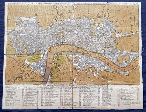
1782 Robert Sayer & John Bennett Large Early Antique Map of London, Rare
- Title : The London Directory or a New & Improved Plan of London, Westminster & Southwark; with the adjacent Country, the New Buildings, the New Roads and the late alterations by Opening of New Streets, & Widening of others 1782.
- Size: 20 1/2in x 16in (510mm x 410mm)
- Condition: (A) Very Good Condition
- Date : 1782
- Ref #: 93047
Description:
This original copper-plate engraved antique segmented map laid on linen of London was engraved in 1782 - dated - and published by Robert Sayer and John Bennett, London.
General Definitions:
Paper thickness and quality: - Heavy and stable
Paper color : - off white
Age of map color: - Original
Colors used: - Green, brown
General color appearance: - Authentic
Paper size: - 20 1/2in x 16in (510mm x 410mm)
Plate size: - 20 1/2in x 16in (510mm x 410mm)
Margins: - Min 1/2in (12mm)
Imperfections:
Margins: - Age toning
Plate area: - Age toned
Verso: - Linen backed
Background:
A highly appealing 1783 map centered on the Thames River. The map details central London from Islington to Shadwell and from Newington Butts to Tyburn. Only three bridges are shown, across the Thames: Westminster Bridge, London Bridge, and Blackfriars (B.L. Fryers). The portions of the city devastated by the 1666 Great Fire of London is marked. A street index and public building index appears below the map proper. The earliest edition of this map was published by Sayer in 1765, with numerous updates to about 1800 – all states are rare, this being the 7th of 1783. Another, almost identical version of this map was issued by John Carrington and, having a slightly longer lifespan, was published and updated until about 1811.
Sayer, Robert 1725 - 1794
Sayer was an important English map publisher and engraver active from the mid to late 18th century. Sayer was born in Sunderland, England, in 1725. He may have clerked as a young man with the Bank of England, but this is unclear. His brother, James Sayer, married Mary Overton, daughter-in-law of John Overton and widow of Philip Overton. Sayer initially worked under Mary Overton, but by December of 1748 was managing the Overton enterprise and gradually took it over, transitioning the plates to his own name. When Thomas Jefferys went bankrupt in 1766, Sayer offered financial assistance to help him stay in business and, in this way, acquired rights to many of the important Jefferys map plates as well as his unpublished research. From about 1774, he began publishing with his apprentice, John Bennett (fl. 1770-1784), as Sayer and Bennett, but the partnership was not formalized until 1777. Bennett retired in 1784 following a mental collapse and the imprint reverted to Robert Sayer. From 1790, Sayer added Robert Laurie and James Whittle to his enterprise, renaming the firm Robert Sayer and Company. Ultimately, Laurie and Whittle partnered to take over his firm. Sayer retired to Bath, where, after a long illness, he died. During most of his career, Sayer was based at 53 Fleet Street, London. His work is particularly significant for its publication of many British maps relating to the American Revolutionary War. Unlike many map makers of his generation, Sayer was a good businessman and left a personal fortune and great estate to his son, James Sayer, who never worked in the publishing business.
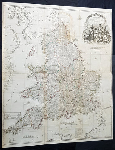
1794 Laurie & Whittle, John Rocque Large Antique Map England & Wales, Sea Battle
- Titles: England and Wales Drawn from the Most Accurate Surveys...by John Rocque...Laurie & whittle...1794
Sizes: 47 1/2in x 39 1/2in (1.21m x 1.050m) - Condition: (A) Very Good Condition
- Date: 1794
- Ref #: 93417-1
Description:
This very large - 4 sheet joined - famous mid 18th century original hand coloured copper-plate engraved antique map of England and Wales, by John Rocque, was published by Laurie & Whittle in the large 1794 - dated - of A General Atlas Describing the Whole Universe.
General Definitions:
Paper thickness and quality: - Heavy and stable
Paper color : - off white
Age of map color: - Original
Colors used: - Yellow, green, blue, pink
General color appearance: - Authentic
Paper size: - 47 1/2in x 39 1/2in (1.21m x 1.050m)
Plate size: - 47 1/2in x 39 1/2in (1.21m x 1.050m)
Margins: - Min 1/2in (10mm)
Imperfections:
Margins: - None
Plate area: - Folds as issued, offsetting, uplift and creasing along some folds
Verso: - Folds as issued
Background:
The map exemplifies the strong graphic presence of Rocques signature topographic detail as well as an elaborate cartouche, here uncolored as issued. Rocque is recognized as an innovator of the British town plan and a master of large-scale cartographic style. The map of England and Wales was conceived during the high point of the map makers career and seems to have been completed as a part of a series of four-sheet British Isles maps.
A wonderfully detailed four-sheet map with title contained within a large decorative allegorical cartouche depicting the artistic, scientific, and commercial accomplishments of the English. Abbeys and castles are duly noted. Small inset of the Isles of Scilly. Tall ships sailing solo and as part of fleets decorate the seas around the islands.
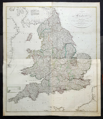
1803 Thomas Kitchen & Johannes Walch Large Antique Wall Map of England & Wales
- Titles: Carte von England und Wallli...Herren Thomas Kitchin Augsburg in Verlag bey Johannes Walch 1803
Sizes: 53in x 45in (1.345m x 1.120m) - Condition: (A+) Fine Condition
- Date: 1803
- Ref #: 93420
Description:
This very large original copper plate engraved antique wall map of England & Wales after the English cartographer Thomas Kitchin was engraved and published by the German publisher Johannes Walch in 1803, dated.
First published by Kitchin in London in 1760, this incredibly large, detailed & scarce map is a credit to Kitchin, one of the foremost cartographers of the 18th century.
General Definitions:
Paper thickness and quality: - Heavy and stable
Paper color : - off white
Age of map color: - Original
Colors used: - Blue, pink, red, green, yellow
General color appearance: - Authentic
Paper size: - 53in x 45in (1.345m x 1.120m)
Plate size: - 50 1/2in x 43in (1.280m x 1.090m)
Margins: - Min 1in (25mm)
Imperfections:
Margins: - None
Plate area: - None
Verso: - None
Background:
Johann Walch 1757 - 1815 was a German painter, draftsman, engraver, cartographer and publisher. Walch was the son of the merchant and amateur painter and copper engraver Sebastian Walch (1721–1788) and his wife Katharina Zorn, daughter of the butcher Martin Zorn. He received training as a miniature painter in Augsburg, Geneva and three years at the Vienna Art Academy . This was followed by a two-year trip to Italy. Before 1785 he settled in Augsburg, where on January 16, 1786 he married Anna Regina Will the eldest daughter of the copper engraver and publisher Johann Martin Will , who was based in Augsburg, and was married in the publishing house worked with his father-in-law. As a result, the publisher increasingly turned to map production .
In 1789 he inherited from Gustav Conrad Lotter (1746–1776) map material from the map publishers Matthäus Seutter and Tobias Conrad Lotter, almost 25,000 individual map sheets and 208 copper plates. After Wills death in 1806, he inherited Willschen Verlag , which he developed into a major map publisher (Joh. Walchsche Landkarte Handlung). This gave rise to the print shop named Joh. Walch . His son Johann Sebastian Walch (1787-1840) continued the publishing house.
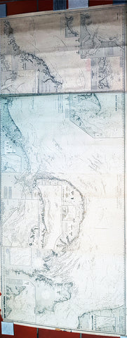
1888 Norie & Wilson Large Blue Back Map of East England - London to Newcastle
- Title : East Coast of England from Dugrness to Newcastle in Four Sheets...Charles Wilson )Late Norie & Wilson) London...1887, 1888 Drawn by J. S. Hobb Hydrographer
- Size: 94in x 34 1/2in (2.39m x 875mm)
- Condition: (A+) Fine Condition
- Date : 1887/88
- Ref #: 93113
Description:
This is a very large, extremely rare, blueback Nautical Map a chart of the East Coast of England, in 4 sheets joined, from Hastings in Kent to Newcastle, Durham was published by Norie & Wilson in 1887, with updates to 1888.
This extremely large blueback working map is extremely detailed with much detail of the Thames Estuary to London, with depth soundings, detailed surveys and many insert maps of Harwich, Lynn & Boston, France & Calais, Lowestaff & Yarmouth Roads, River Humber Entrance, South & North Shields, Seaham, Scarborough, Tees Bay & Sunderland Port. As stated these original blueback working maps are rare and scarce to the market. I have been unable to find this map available to purchase.
This rare Blueback map, a method of mounting working sea charts that was begun by Robert Sayer in the late 18th century. These working maps were extremely expensive to buy and labour intensive to put together so only a limited number were published and sold and even fewer have survived. I have found no other examples of this map either commercially or in other map collections.
General Definitions:
Paper thickness and quality: - Heavy and stable
Paper color : - off white
Age of map color: -
Colors used: -
General color appearance: -
Paper size: - 94in x 34 1/2in (2.39m x 875mm)
Plate size: - 94in x 34 1/2in (2.39m x 875mm)
Margins: - Min 1/2in (12mm)
Imperfections:
Margins: - Small uplift off the blue back, not affecting the map
Plate area: - None
Verso: - Small repair right end of blueback
Background:
Blueback nautical charts began appearing in London in the late 18th century. Bluebacks, as they came to be called, were privately published large format nautical charts known for their distinctive blue paper backing. The backing, a commonly available blue manila paper traditionally used by publishers to warp unbound pamphlets, was adopted as a practical way to reinforce the low-quality paper used by private chart publishers in an effort to cut costs. The earliest known Blueback charts include a 1760 chart issued by Mount and Page, and a 1787 chart issued by Robert Sayer. The tradition took off in the early 19th century, when British publishers like John Hamilton Moore, Robert Blachford, James Imray, William Heather, John William Norie, Charles Wilson, David Steel, R. H. Laurie, and John Hobbs, among others, rose to dominate the chart trade. Bluebacks became so popular that the convention was embraced by chartmakers outside of England, including Americans Edmund March Blunt and George Eldridge, as well as Scandinavian, French, German, Russian, and Spanish chartmakers. Blueback charts remained popular until the late 19th century, when government subsidized organizations like the British Admiralty Hydrographic Office and the United States Coast Survey, began issuing their own superior charts on high quality paper that did not require reinforcement.
Norie, John William 1772–1843
John William Norie was an important hydrographer, chartmaker and publisher, as also a writer on navigation and publisher of nautical manuals, as well as selling globes and all manner of nautical instruments. He was agent for the sale of Admiralty charts, and chart seller to the East India Company and Trinity House. He was born in London of Scottish parent, and apprenticed to William Heather, a noted chartmaker, as a draughtsman, and his first charts appear under the Heather imprint from 1795 onwards.
In 1813 he bought William Heathers business, in partnership with Charles Wilson; the partnership lasted until 1840, when Heather sold his share of the business to Wilson and retired. Wilson continued to trade as Norie and Wilson; the firm merged with J. Imray and Son in 1899, and survives to the present as Imray, Laurie, Norie and Wilson Ltd.
Norie had a prolific output of charts, reissuing Heathers stock and adding new charts of his own making of all parts of the world, these too many to list. Important publications include his A new and complete epitome of practical navigation (1805); A complete pilot for the south coasts of England and Ireland (1817); The new Mediterranean pilot, containing sailing directions for the coasts of France, Spain, and Portugal, from Ushant to Gibraltar (1817) and Nories set of celestial maps for finding the principal stars in the heavens (1825).
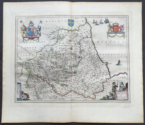
1647 Blaeu Old, Antique Map of The English County of Durham
- Title : Episcopatus Dunelmensis Vulgo The Bishoprike of Durham
- Ref #: 60009
- Size: 24in x 20in (610mm x 510mm)
- Date : 1647
- Condition: (A+) Fine Condition
Description:
This beautifully hand coloured original antique map of the English county of Durham was published in the 1647 Dutch edition of Joan Blaeus Atlas Novus.
Blaeu's reference for the topographical data for this map derive from John Speeds maps of Great Britain from the 1611 Empire of Great Britaine - the beautiful decoration, though, is distinctly Blaeus.
Background: Blaeu is one of the most revered map makers of all time and it is easy to see why in this beautiful original map.
The high level of the topographical detail, the quality of the paper, the artistic professionalism of the engraving and the beauty of the original hand colouring combine to produce a work of art that is both functional and of exceptional beauty. (Ref: Koeman; M&B)
General Description:
Paper thickness and quality: - Heavy and stable
Paper color: - off white
Age of map color: - Original
Colors used: - Yellow, pink, red, blue, green
General color appearance: - Authentic
Paper size: - 24in x 20in (610mm x 510mm)
Plate size: - 20in x 15 1/2in (510mm x 395mm)
Margins: - Min 1in (25mm)
Imperfections:
Margins: - None
Plate area: - None
Verso: - None
1899 Daily Map Antique Map South Africa 2nd Boer War Handkerchief R Kipling Poem
- Title : The Absent-Minded Beggar....South African Republic
- Ref #: 93380
- Size: 18in x 17in (465mm x 435mm)
- Date : 1899
- Condition: (A+) Fine Condition
Description:
This scarce item of ephemera, an original printed linen antique handkerchief, with a map of The South African Republic, was published in 1899 by the Daily Mail to raise funds for the Soldiers Families Fund, after the outbreak of the Second Boer War (1899-1902), the first charitable effort for a war.
The map shows the theatre of war, around the South African Republic (the Transvaal) and the Orange Free State. The two portraits are of Lord Roberts, commander of the British Troops, and Queen Victoria, the British Monarch for the first half of the war.
The poem, The Absent-Minded Beggar by Rudyard Kipling, was specially commissioned for the Fund, and was given a musical score by Arthur Sullivan (of Gilbert & Sullivan fame).
General Definitions:
Paper thickness and quality: - Heavy and stable
Paper color : - off white
Age of map color: - Original
Colors used: - Yellow, green, blue, pink
General color appearance: - Authentic
Paper size: - 18in x 17in (465mm x 435mm)
Plate size: - 18in x 17in (465mm x 435mm)
Margins: - Min 1/2in (12mm)
Imperfections:
Margins: - None
Plate area: - None
Verso: - None
Background:
Despite Roberts portait being entwined in the title, the absent-minded beggar of Kiplings poem is the British Tommy (private soldier), forgetfully leaving their dependents in need while fighting for their country. The Daily Mail paid Kipling £250 for the poem, which he donated to the fund, as did Sullivan with his £100 payment. Soon afterwards Kipling was offered a knighthood, which he declined. It was not Kiplings favourite work: in his autobiography he wrote that it lacked poetry and became wedded... to a tune guaranteed to pull teeth out of barrel-organs. This did not stop it being a huge success, giving the fund the nickname, the Absent-Minded Beggar Relief Corps, and helping it raise £340,000 by the time it was wound up in 1903. Not only was it published worldwide (the New York Journal paid $25 for the privilege), it was recited by actresses including Lily Langtree and Lady Maud Beerbohm Tree.
Organising the fund was a coup for the Daily Mail, which had been founded only in 1896. This campaign capitalised on the jingoistic mood of the British public and the papers circulation soared to over a million issues a day by 1902, the highest in the world.
This handkerchief is probably the most famous item of British ephemera produced during the South African War.
The Absent-Minded Beggar is an 1899 poem by Rudyard Kipling, set to music by Sir Arthur Sullivan and often accompanied by an illustration of a wounded but defiant British soldier, A Gentleman in Kharki, by Richard Caton Woodville. The song was written as part of an appeal by the Daily Mail to raise money for soldiers fighting in the Second Boer War and their families. The fund was the first such charitable effort for a war.
The chorus of the song exhorted its audience to pass the hat for your credits sake, and pay– pay– pay! The patriotic poem and song caused a sensation and were constantly performed throughout the war and beyond. Kipling was offered a knighthood shortly after publication of the poem but declined the honour. Vast numbers of copies of the poem and sheet music were published, and large quantities of related merchandise were sold to aid the charity.
Daily Mail Publishing Co. Ltd 1896 -
The Daily Mail, devised by Alfred Harmsworth (later Viscount Northcliffe) and his brother Harold (later Viscount Rothermere), was first published on 4 May 1896. It was an immediate success. It cost a halfpenny at a time when other London dailies cost one penny, and was more populist in tone and more concise in its coverage than its rivals. The planned issue was 100,000 copies but the print run on the first day was 397,215 and additional printing facilities had to be acquired to sustain a circulation which rose to 500,000 in 1899. Lord Salisbury, 19th-century Prime Minister of the United Kingdom, dismissed the Daily Mail as a newspaper produced by office boys for office boys. By 1902, at the end of the Boer Wars, the circulation was over a million, making it the largest in the world.
With Harold running the business side of the operation and Alfred as Editor, the Mail from the start adopted an imperialist political stance, taking a patriotic line in the Second Boer War, leading to claims that it was not reporting the issues of the day objectively. From the beginning, the Mail also set out to entertain its readers with human interest stories, serials, features and competitions (which were also the main means by which the Harmsworths promoted the paper).
In 1900 the Daily Mail began printing simultaneously in both Manchester and London, the first national newspaper to do so (in 1899, the Daily Mail had organised special trains to bring the London-printed papers north). The same production method was adopted in 1909 by the Daily Sketch, in 1927 by the Daily Express and eventually by virtually all the other national newspapers. Printing of the Scottish Daily Mail was switched from Edinburgh to the Deansgate plant in Manchester in 1968 and, for a while, The People was also printed on the Mail presses in Deansgate. In 1987, printing at Deansgate ended and the northern editions were thereafter printed at other Associated Newspapers plants.
In 1906 the paper offered £10,000 for the first flight from London to Manchester, followed by a £1,000 prize for the first flight across the English Channel. Punch magazine thought the idea preposterous and offered £10,000 for the first flight to Mars, but by 1910 both the Mails prizes had been won. The paper continued to award prizes for aviation sporadically until 1930.
Before the outbreak of World War I, the paper was accused of warmongering when it reported that Germany was planning to crush the British Empire. When war began, Northcliffes call for conscription was seen by some as controversial, although he was vindicated when conscription was introduced in 1916. On 21 May 1915, Northcliffe criticised Lord Kitchener, the Secretary of State for War, regarding weapons and munitions. Kitchener was considered by some to be a national hero. The papers circulation dropped from 1,386,000 to 238,000. Fifteen hundred members of the London Stock Exchange burned unsold copies and called for a boycott of the Harmsworth Press. Prime Minister H. H. Asquith accused the paper of being disloyal to the country.
When Kitchener died, the Mail reported it as a great stroke of luck for the British Empire. The paper was critical of Asquiths conduct of the war, and he resigned on 5 December 1916. His successor David Lloyd George asked Northcliffe to be in his cabinet, hoping it would prevent him from criticising the government. Northcliffe declined.
As Lord Northcliffe aged, his grip on the paper slackened and there were periods when he was not involved. But light-hearted stunts enlivened him, such as the Hat campaign in the winter of 1920. This was a contest with a prize of £100 for a new design of hat – a subject in which Northcliffe took a particular interest. There were 40,000 entries and the winner was a cross between a top hat and a bowler christened the Daily Mail Sandringham Hat. The paper subsequently promoted the wearing of it but without much success. In 1922, when Lord Northcliffe died, Lord Rothermere took full control of the paper.
In 1919, Alcock and Brown made the first flight across the Atlantic, winning a prize of £10,000 from the Daily Mail. In 1930 the Mail made a great story of another aviation stunt, awarding another prize of £10,000 to Amy Johnson for making the first solo flight from England to Australia.
The Daily Mail had begun the Ideal Home Exhibition in 1908. At first, Northcliffe had disdained this as a publicity stunt to sell advertising and he refused to attend. But his wife exerted pressure upon him and he changed his view, becoming more supportive. By 1922 the editorial side of the paper was fully engaged in promoting the benefits of modern appliances and technology to free its female readers from the drudgery of housework. The Mail maintained the event until selling it to Media 10 in 2009.
On 25 October 1924, the Daily Mail published the forged Zinoviev letter, which indicated that British Communists were planning violent revolution. This was thought by some a significant factor in the defeat of Ramsay MacDonalds Labour Party in the 1924 general election, held four days later.
Unlike most newspapers, the Mail quickly took up an interest on the new medium of radio. In 1928, the newspaper established an early example of an offshore radio station aboard a yacht, both as a means of self-promotion and as a way to break the BBCs monopoly. However, the project failed as the equipment was not able to provide a decent signal from overboard, and the transmitter was replaced by a set of speakers. The yacht spent the summer entertaining beach-goers with gramophone records interspersed with publicity for the newspaper and its insurance fund. The Mail was also a frequent sponsor on continental commercial radio stations targeted towards Britain throughout the 1920s and 1930s and periodically voiced support for the legalisation of private radio, something that would not happen until 1973.
From 1923 Lord Rothermere and the Daily Mail formed an alliance with the other great press baron, Lord Beaverbrook. Their opponent was the Conservative Party politician and leader Stanley Baldwin. By 1929 George Ward Price was writing in the Mail that Baldwin should be deposed and Beaverbrook elected as leader. In early 1930 the two Lords launched the United Empire Party which the Daily Mail supported enthusiastically.
The rise of the new party dominated the newspaper and, even though Beaverbrook soon withdrew, Rothermere continued to campaign. Vice Admiral Ernest Augustus Taylor fought the first by-election for the United Empire Party in October, defeating the official Conservative candidate by 941 votes. Baldwins position was now in doubt, but in 1931 Duff Cooper won the key by-election at St Georges, Westminster, beating the United Empire Party candidate, Sir Ernest Petter, supported by Rothermere, and this broke the political power of the press barons.
In 1927, the celebrated picture of the year Morning by Dod Procter was bought by the Daily Mail for the Tate Gallery.
Lord Rothermere was a friend of Benito Mussolini and Adolf Hitler, and directed the Mails editorial stance towards them in the early 1930s. Rothermeres 1933 leader Youth Triumphant praised the new Nazi regimes accomplishments, and was subsequently used as propaganda by them. In it, Rothermere predicted that The minor misdeeds of individual Nazis would be submerged by the immense benefits the new regime is already bestowing upon Germany. Journalist John Simpson, in a book on journalism, suggested that Rothermere was referring to the violence against Jews and Communists rather than the detention of political prisoners.
Rothermere and the Mail were also editorially sympathetic to Oswald Mosley and the British Union of Fascists. Rothermere wrote an article titled Hurrah for the Blackshirts published in the Daily Mail on 15 January 1934, praising Mosley for his sound, commonsense, Conservative doctrine and pointing out that: Young men may join the British Union of Fascists by writing to the Headquarters, Kings Road, Chelsea, London, S.W.
The Spectator condemned Rothermeres article commenting that, ... the Blackshirts, like the Daily Mail, appeal to people unaccustomed to thinking. The average Daily Mail reader is a potential Blackshirt ready made. When Lord Rothermere tells his clientele to go and join the Fascists some of them pretty certainly will.
The papers support ended after violence at a BUF rally in Kensington Olympia in June 1934. Mosley and many others thought Rothermere had responded to pressure from Jewish businessmen who it was believed had threatened to stop advertising in the paper if it continued to back an anti-Semitic party. The paper editorially continued to oppose the arrival of Jewish refugees escaping Germany, describing their arrival as a problem to which the Daily Mail has repeatedly pointed.
On 5 May 1946, the Daily Mail celebrated its Golden Jubilee. Winston Churchill was the chief guest at the banquet and toasted it with a speech. Newsprint rationing in the Second World War had forced the Daily Mail to cut its size to four pages, but the size gradually increased through the 1950s.
The Daily Mail was transformed by its editor during the 1970s and 1980s, David English. He had been editor of the Daily Sketch from 1969 to 1971, when it closed. Part of the same group from 1953, the Sketch was absorbed by its sister title, and English became editor of the Mail, a post in which he remained for more than 20 years. English transformed it from a struggling newspaper selling half as many copies as its mid-market rival, the Daily Express, to a formidable publication, whose circulation rose to surpass that of the Express by the mid-1980s. English was knighted in 1982.
The paper enjoyed a period of journalistic success in the 1980s, employing some of the most inventive writers in old Fleet Street including the gossip columnist Nigel Dempster, Lynda Lee-Potter and sportswriter Ian Wooldridge (who unlike some of his colleagues—the paper generally did not support sporting boycotts of white-minority-ruled South Africa—strongly opposed apartheid). In 1982 a Sunday title, the Mail on Sunday, was launched (the Scottish Sunday Mail, now owned by the Mirror Group, was founded in 1919 by the first Lord Rothermere, but later sold.
1659 Joan Blaeu Large Antique Map of Jersey and Guernsey British Channel Islands
- Title : Sarnia Insula Vulgo Garnsey: et Insula Caesarrea vernacule Jarsey
- Date : 1659
- Condition: (A+) Fine Condition
- Ref: 43170
- Size: 21in x 19in (535mm x 480mm)
Description:
This original large hand coloured copper plate engraved antique map of the Channel Islands Jersey and Guernsey and smaller islands was published in the 1659 Spanish edition of Joan Blaeu's Atlas Novus.
This map is in beautiful condition, large margins, strong sturdy clean paper and bright fresh original colouring.
Condition Report:
Paper thickness and quality: - Heavy and stable
Paper color: - off white
Age of map color: - Original
Colors used: - Yellow, pink, red, blue, green
General color appearance: - Authentic
Paper size: - 21in x 19in (535mm x 480mm)
Plate size: - 18 1/2in x 15 1/2in (480mm x 400mm)
Margins: - Min 1in (25mm)
Imperfections:
Margins: - None
Plate area: - Very light crease along centerfold
Verso: - None
Background: The Channel Islands (Norman: Îles d'la Manche, French: Îles Anglo-Normandes orÎles de la Manche) are an archipelago of British Crown Dependencies in the English Channel, off the French coast of Normandy. They include two separate bailiwicks: the Bailiwick of Jersey and the Bailiwick of Guernsey. They are considered the remnants of the Duchy of Normandy, and are not part of the United Kingdom. They have a total population of about 168,000 and their respective capitals, Saint Helier and Saint Peter Port, have populations of 33,500 and 16,488, respectively. The total area of the islands is 194 km.
Both Bailiwicks have been administered separately since the late 13th century; each has its own independent laws, elections, and representative bodies (although in modern times, politicians from the islands' legislatures are in regular contact). Any institution common to both is the exception rather than the rule.
Blaeu is one of the most revered map makers of all time and it is easy to see why in this beautiful original map. The high level of the topographical detail, the quality of the paper, the artistic professionalism of the engraving and the beauty of the original hand colouring combine to produce a work of art that is both functional and of exceptional beauty. (Ref: Koeman; M&B)
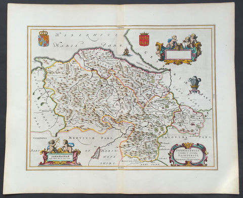
1647 Blaeu Antique Map of The Welsh Counties of Denbigh & Flintshire
- Title : Denbigiensis comitatus et Comitatus Flintensis - Denbigh et Flintshire
- Ref #: 31034
- Size: 24in x 20in (610mm x 510mm)
- Date : 1647
- Condition: (A+) Fine Condition
Description:
This beautifully hand coloured original antique map of the Welsh counties of Denbigh & Flintshire was published in the 1647 Dutch edition of Joan Blaeus Atlas Novus.
Blaeu's reference for the topographical data for this map derive from John Speeds maps of Great Britain from the 1611 Empire of Great Britaine - the beautiful decoration, though, is distinctly Blaeus.
Background: Blaeu is one of the most revered map makers of all time and it is easy to see why in this beautiful original map.
The high level of the topographical detail, the quality of the paper, the artistic professionalism of the engraving and the beauty of the original hand colouring combine to produce a work of art that is both functional and of exceptional beauty. (Ref: Koeman; M&B)
General Description:
Paper thickness and quality: - Heavy and stable
Paper color: - White
Age of map color: - Early
Colors used: - Yellow, pink, red, blue, green
General color appearance: - Authentic
Paper size: - 24in x 20in (610mm x 510mm)
Plate size: - 19 1/2in x 15in (495mm x 380mm)
Margins: - Min 1in (25mm)
Imperfections:
Margins: - None
Plate area: - None
Verso: - None
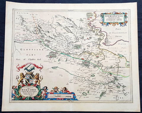
1645 Joan Blaeu Large Antique Map of The County of Stirling, Scotland, Falkirk
- Title : Sterlinensis Praefcture...Sterlin-Shyr...Auct Timoth. Pont
- Ref #: 93511
- Size: 23in x 18 1/2in (585mm x 480mm)
- Date : 1645
- Condition: (A+) Fine Condition
Description:
This large original beautifully hand coloured copper plate engraved antique map of the Scottish County of Stirling, on the river Forth just north of Edinburgh, was published in the 1645 Latin edition of Joan Blaeus Atlas Novus..
This is a beautiful map with magnificent original hand colouring, on clean paper with a heavy impression.
When Blaeu published his volume of Great Britain & Ireland, Atlas Novus, Scotland became one of the best-mapped countries in the world. The atlas contained maps of forty-nine separate maps of Scotland (plus a map of Ptolemy GB and six maps of Ireland). The first two plates from the atlas show the entire country ancient and modern, whilst the remaining forty-six plates cover most Scotland in forty-seven regional maps. In total the regional maps locate some 20,000 different place names. A clue as to the reason for this extraordinary explosion of geographical information is to be found on thirty-six of the regional maps, which all carry engraved credits to Timothy Pont (1524-1606)
Pont was responsible for surveying the greater part of Scotland between 1583-1600, the resulting Pont Manuscript maps were never published but were put to good use some fifty to seventy years later by Robert Gordon and Joan Blaeu. (Ref: Koeman; Tooley; M&B)
General Definitions:
Paper thickness and quality: - Heavy and stable
Paper color : - off white
Age of map color: - Original
Colors used: - Blue, pink, red, green, yellow
General color appearance: - Authentic
Paper size: - 23in x 18 1/2in (585mm x 480mm)
Plate size: - 20in x 16 1/2in (510mm x 420mm)
Margins: - Min 1in (25mm)
Imperfections:
Margins: - None
Plate area: - None
Verso: - None
Background:
Stirlingshire or the County of Stirling is an historic county and registration county of Scotland. Its county town is Stirling. It borders Perthshire to the north, Clackmannanshire and West Lothian to the east, Lanarkshire to the south, and Dunbartonshire to the south-east and south-west.
In 1130, Stirling, one of the principal royal strongholds of the Kingdom of Scotland, was created a Royal burgh by King David I. On 11 September 1297, the forces of Andrew Moray and William Wallace defeated the combined English forces of John de Warenne, 6th Earl of Surrey, and Hugh de Cressingham near Stirling, on the River Forth, at the Battle of Stirling Bridge during the First War of Scottish Independence.
On 22 July 1298 the Battle of Falkirk saw the defeat of William Wallace by King Edward I of England.
On 24 June 1314 the Battle of Bannockburn at Bannockburn, (Blàr Allt a\' Bhonnaich in Scottish Gaelic) was a significant Scottish victory in the Wars of Scottish Independence. It was one of the decisive battles of the First War of Scottish Independence.
On 11 June 1488 the Battle of Sauchieburn was fought at the side of Sauchie Burn, a stream about two miles south of Stirling, Stirlingshire, Scotland.[4] The battle was fought between the followers of King James III of Scotland and a large group of rebellious Scottish nobles including Alexander Home, 1st Lord Home, nominally led by the king\'s 15-year-old son, Prince James, Duke of Rothesay (reigned 1488–1513).
In 1645 the Covenanter army under General William Baillie formed near Banton for their engagement with the Royalist forces under the command of Montrose at the Battle of Kilsyth, Kilsyth, on 15 August 1645; a major battle of the Wars of the Three Kingdoms.
The Battle of Falkirk Muir on 17 January 1746 saw the Jacobites under Charles Edward Stuart defeat a government army commanded by Lieutenant General Henry Hawley.
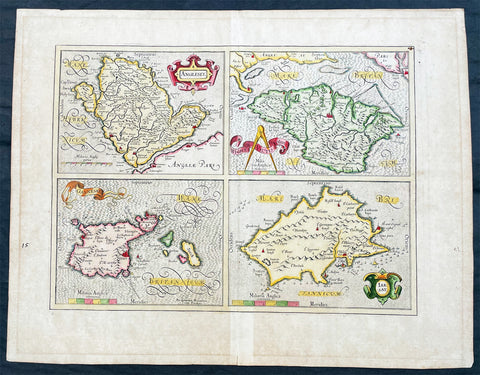
1606 Gerard Mercator Antique Map British Islands Anglesey, Wight Guernsey Jersey
- Title : Anglesey; Wight Vectis, olim; Garnesay: Jarsay
- Ref #: 17014
- Size: 21 1/2in x 17in (550mm x 430mm)
- Date : 1606
- Condition: (A+) Fine Condition
Description:
This beautifully hand coloured original copper plate engraved antique map of the 4 British Islands of Anglesey, Wight Guernsey Jersey by Gerard Mercator was published by Henricus Hondius in the 1606 edition of Mercators Atlas, Atlas Sive Cosmographicae Meditationes Illustrissimi Ducis.
This map is beautiful with early original hand colour, heavy dark impression, on heavy paper and original margins.
General Definitions:
Paper thickness and quality: - Heavy and stable
Paper color : - off white
Age of map color: - Early
Colors used: - Yellow, green, blue, pink
General color appearance: - Authentic
Paper size: - 21 1/2in x 17in (550mm x 430mm)
Plate size: - 17 1/4in x 12 1/2in (440mm x 315mm)
Margins: - Min 2in (50mm)
Imperfections:
Margins: - Age toning in margins
Plate area: - None
Verso: - Age Toning
Anglesey is an island off the north-west coast of Wales. The English name of the island may be derived from the Old Norse; either Ǫngullsey Hook Island or Ǫnglisey Ǫngli's Island. No record of such an Ǫngli survives, but the place name was used by Viking raiders as early as the 10th century and later adopted by the Normans during their invasions of Gwynedd. The traditional folk etymology reading the name as the Island of the Angles (English)] may account for its Norman use but has no merit, as the Angles name itself is probably cognate with the shape of the Angeln peninsula. All of them ultimately derive from the proposed Proto-Indo-European root *ank- (to flex, bend, angle). Throughout the 18th and 19th centuries and into the 20th, it was usually spelt Anglesea in documents.
The oldest records that give a name for the Isle of Wight are from the Roman Empire: it was then called Vectis or Vecta in Latin, Iktis or Ouiktis in Greek. From the Anglo-Saxon period Latin Vecta, Old English Wiht and Old Welsh forms Gueid and Guith are recorded. In Domesday Book it is Wit; the modern Welsh name is Ynys Wyth (ynys = island). These are all variant forms of the same name, possibly Celtic in origin. It may mean "place of the division", because the island divides the two arms of the Solent.
The Channel Islands are an archipelago of British Crown Dependencies in the English Channel, off the French coast of Normandy. They include two separate bailiwicks: the Bailiwick of Jersey and the Bailiwick of Guernsey. They are considered the remnants of the Duchy of Normandy, and are not part of the United Kingdom. They have a total population of about 168,000 and their respective capitals, Saint Helier and Saint Peter Port, have populations of 33,500 and 16,488, respectively. The total area of the islands is 194 km.
Both Bailiwicks have been administered separately since the late 13th century; each has its own independent laws, elections, and representative bodies (although in modern times, politicians from the islands' legislatures are in regular contact). Any institution common to both is the exception rather than the rule.
Please note all items auctioned are genuine, we do not sell reproductions. A Certificate of Authenticity (COA) can be issued on request.
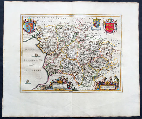
1664 Joan Blaeu Large Antqiue Map The Welsh County of Montgomery
-
Title : Montgomeria Comitatus et Comitatus Mervinia
- Date : 1664
- Condition: (A+) Fine Condition
- Ref: 01-4004
- Size: 25 1/2in x 21 1/2in (650mm x 545mm)
Description:
This beautifully hand coloured original antique map of the Welsh County of Montgomery was published in the 1664 Dutch edition of Joan Blaeus Atlas Major.
Blaeus reference for the topographical data is from John Speeds maps from the 1611 Empire of Great Britaine - the beautiful decoration, though, is distinctly Blaeus. (Ref: Koeman; Tooley; M&B)
General Description:
Paper thickness and quality: - Heavy and stable
Paper color: - White
Age of map color: - Early
Colors used: - Yellow, pink, red, blue, green
General color appearance: - Authentic
Paper size: - 25 1/2in x 21 1/2in (650mm x 545mm)
Plate size: - 20in x 16 1/2in (510mm x 420mm)
Margins: - Min 2in (50mm)
Imperfections:
Margins: - None
Plate area: - None
Verso: - None
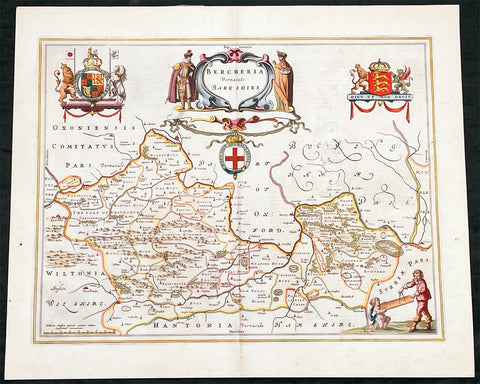
1662 Joan Blaeu Antique Map of the English County of Berkshire
- Title : Bercheria Vernaeule Barkshire
- Ref #: 27013
- Size: 22 1/4in x 18 1/2in (565mm x 470mm)
- Date : 1662
- Condition: (A) Very Good Condition
Description:
This original beautifully hand coloured antique map of the English County of Berkshire by Joan Blaeu was published in the 1662 edition of Atlas Major. (Ref: Tooley; M&B)
General Definitions:
Paper thickness and quality: - Heavy and stable
Paper color : - off white
Age of map color: - Original
Colors used: - Yellow, green, blue, pink
General color appearance: - Authentic
Paper size: - 22 1/4in x 18 1/2in (565mm x 470mm)
Plate size: - 19 3/4in x 15in (500mm x 380mm)
Margins: - Min 1/2in (10mm)
Imperfections:
Margins: - None
Plate area: - Small abrasion to right of map image
Verso: - Age toning
Please note all items auctioned are genuine, we do not sell reproductions. A Certificate of Authenticity (COA) can be issued on request.
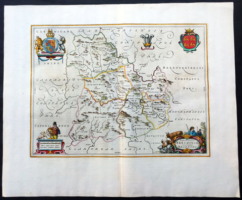
1664 Blaeu Large Antique Map of The Welsh County of Breknock
- Title : Comitatus Brechiniae Breknoke
- Ref #: 01-4244
- Size: 25 1/2in x 21 1/2in (650mm x 545mm)
- Date : 1664
- Condition: (A+) Fine Condition
Description:
This beautifully hand coloured original antique map of the Welsh county of Brecknock was published in the 1664 Dutch edition of Joan Blaeus Atlas Major.
Blaeus reference for the topographical data is from John Speeds maps from the 1611 Empire of Great Britaine - the beautiful decoration, though, is distinctly Blaeus.
This is a beautiful map with a deep impression, original margins, wonderful hand colouring and strong, stable paper. (Ref: Koeman; Tooley; M&B)
General Description:
Paper thickness and quality: - Heavy and stable
Paper color: - White
Age of map color: - Later
Colors used: - Yellow, pink, red, blue, green
General color appearance: - Authentic
Paper size: - 25 1/2in x 21 1/2in (650mm x 545mm)
Plate size: - 20in x 15in (510mm x 380mm)
Margins: - Min 2in (50mm)
Imperfections:
Margins: - None
Plate area: - None
Verso: - None
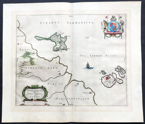
1647 Blaeu Old Antique Map Lindisfarne Holy Islands England - Early Christianity
- Title : Insula Sacra Vulgo Holy Isand et Farne
- Ref #: 60007
- Size: 24in x 20in (610mm x 510mm)
- Date : 1647
- Condition: (A+) Fine Condition
Description:
This beautifully hand coloured original antique map of the Holy & Farne Islands off the east coast of Northumberland, England was published in the 1647 Dutch edition of Joan Blaeus Atlas Novus.
Blaeu's reference for the topographical data for this map derive from John Speeds maps of Great Britain from the 1611 Empire of Great Britaine - the beautiful decoration, though, is distinctly Blaeus.
Background: Blaeu is one of the most revered map makers of all time and it is easy to see why in this beautiful original map.
The high level of the topographical detail, the quality of the paper, the artistic professionalism of the engraving and the beauty of the original hand colouring combine to produce a work of art that is both functional and of exceptional beauty. (Ref: Koeman; M&B)
General Description:
Paper thickness and quality: - Heavy and stable
Paper color: - off white
Age of map color: - Original
Colors used: - Yellow, pink, red, blue, green
General color appearance: - Authentic
Paper size: - 24in x 20in (610mm x 510mm)
Plate size: - 20in x 15 1/2in (510mm x 395mm)
Margins: - Min 1in (25mm)
Imperfections:
Margins: - None
Plate area: - None
Verso: - None
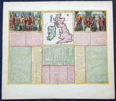
1719 Henri Chatelain Large Antique Map Great Britain & Ireland Allegorical Views
- Title : Carte Du Gouvernment Militaire D Angleterre...
- Ref #: 93425
- Size: 20 1/2in x 18 1/2in (510mm x 470mm)
- Date : 1719
- Condition: (A+) Fine Condition
Description:
This large beautifully hand coloured original copper plate engraved antique map of Great Britain & Ireland, with two large allegorical views, was published by Henri Abraham Chatelain in 1719, in his famous Atlas Historique.
General Definitions:
Paper thickness and quality: - Heavy and stable
Paper color : - off white
Age of map color: - Early
Colors used: - Yellow, green, blue, pink
General color appearance: - Authentic
Paper size: - 20 1/2in x 18 1/2in (510mm x 470mm)
Plate size: - 18 1/2in x 14in (470mm x 355mm)
Margins: - Min 1in (25mm)
Imperfections:
Margins: - None
Plate area: - None
Verso: - None
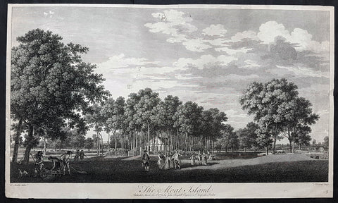
1772 John Boydell Antique Print of Moat Island Eight Views of Windsor Great Park
- Title : The Moat Island Published March the 2nd 1772 by John Boydell Engraver in Cheapside London
- Size: 23 1/2in x 13 1/2in (595mm x 340mm)
- Condition: (B) Good Condition
- Date : 1772
- Ref #: 91158-1
Description:
This large original copper-plate engraved antique print of The Moat Island in Great Windsor Park by Thomas Sandby was engraved by François Vivares and published by John Boydell for the 1772 edition of Eight Views of Windsor Great Park
Thomas Sandby RA 1721 – 1798 was an English draughtsman, watercolour artist, architect and teacher. In 1743 he was appointed private secretary to the Duke of Cumberland, who later appointed him Deputy Ranger of Windsor Great Park, where he was responsible for considerable landscaping work.
Along with his younger brother Paul, he was one of the founding members of the Royal Academy in 1768, and was its first professor of architecture. His most notable architectural work was the Freemason\'s Hall in London (now demolished).
Francois Vivares 1709 – 1780 was a French landscape-engraver, active in England.
General Definitions:
Paper thickness and quality: - Heavy and stable
Paper color : - off white
Age of map color: -
Colors used: -
General color appearance: -
Paper size: - 23 1/2in x 13 1/2in (595mm x 340mm)
Plate size: - 23 1/2in x 13 1/2in (595mm x 340mm)
Margins: - Min 1/2in (12mm)
Imperfections:
Margins: - Soiling and creasing
Plate area: - Several small tears and holes repaired
Verso: - Repairs as noted
Background:
The set of eight folio plates published in Eight Views of Windsor Great Park executed by Thomas Sandby and his brother Paul with the assistance of several noted English engravers. The 8 views were considered to be the finest set of topographical country house views after Rigauds 1739 Views of Stowe
Thomas Sandby (1721–1798) was an architect who served as draftsman to the Duke of Cumberland at the Battle of Culloden in 1746. With his younger brother Paul, a landscape painter and watercolourist, they were founding members of the Royal Academy in 1768.
Through these engravings, the Duke of Cumberland sought to commemorate his alteration of the park, which had served English royalty since the eleventh century as a hunting and jousting ground and, beginning in the eighteenth century, as a place of formal gardens and walks. (The Duke is pictured in several of the engravings, arriving by carriage, directing workers by a bridge, and discoursing with the King by the river.) The improvements to Windsor Great Park recorded in these engravings include a dam built in 1749, forming an artificial lake, rockwork, a cascade, and a grotto. In 1752, a fifty-ton ships hull was raised from the Thames and fitted up on the artificial lake as a Mandarin Yacht or Chinese Junk. A triangular Gothic belvedere was erected on Shrubs Hill to the south, and a large wooden footbridge was constructed over the water. Renovations were also undertaken at the so-called Great Lodge, which became the Dukes residence at Windsor. In short, these improvements partook of the fashionable taste for picturesque Gothick – that was most noticeably championed by Horace Walpoles contemporary Strawberry Hill villa.
Much of these improvements, which were actually the work of architect Henry Flitcroft, were destroyed by severe floods, which broke the dam at Virginia Water in 1768 and again in 1782. These views therefore provide evidence for the state of the park at that date.
Original sketches and preparatory drawings by Paul and Thomas Sandby related to these engravings survive in the Royal Collection at Windsor Castle, the Victoria and Albert Museum, and the British Museum.
Boydell, John 1720 - 1804
Boydell 1804 was an 18th-century British publisher noted for his reproductions of engravings. He helped alter the trade imbalance between Britain and France in engravings and initiated a British tradition in the art form. A former engraver himself, Boydell promoted the interests of artists as well as patrons and as a result his business prospered.
The son of a land surveyor, Boydell apprenticed himself to William Henry Toms, an artist he admired, and learned engraving. He established his own business in 1746 and published his first book of engravings around the same time. Boydell did not think much of his own artistic efforts and eventually started buying the works of others, becoming a print dealer as well as an artist. He became a successful importer of French prints during the 1750s but was frustrated by their refusal to trade prints in kind. To spark reciprocal trade, he commissioned William Wolletts spectacular engraving of Richard Wilsons The Destruction of the Children of Niobe, which revolutionised the print trade. Ten years later, largely as a result of Boydells initiative, the trade imbalance had shifted, and he was named a fellow of the Royal Society for his efforts.
In the 1790s, Boydell began a large Shakespeare venture that included the establishment of a Shakespeare Gallery, the publication of an illustrated edition of Shakespeares plays, and the release of a folio of prints depicting scenes from Shakespeares works. Some of the most illustrious painters of the day contributed, such as Benjamin West and Henry Fuseli.
Throughout his life, Boydell dedicated time to civic projects: he donated art to government institutions and ran for public office. In 1790 he became Lord Mayor of London. The French Revolutionary Wars led to a cessation in Continental trade at the end of the 1790s. Without this business, Boydells firm declined and he was almost bankrupt at his death in 1804.
In 1751, with his large volume of prints, Boydell moved to larger premises at 90 Cheapside. By 1755, he had published A Collection of One Hundred and Two Views, &C. in England and Wales. This cheap but successful book gave him capital to invest. He became increasingly immersed in the commercial side of the print business and like most print dealers began importing prints to sell. These included print reproductions of landscapes by artists such as Claude Lorrain and Salvator Rosa. The bulk of the imports came from the undisputed masters of engraving during the 18th century: the French. Boydell made a small fortune in the 1750s from these imported prints. His early success was acknowledged in 1760 when he was named a member of the Royal Society.Winifred Friedman, who has written extensively on Boydell, explains that despite this success, [w]hat rankled Boydell was that the French would not extend credit, or exchange prints; he was required to produce hard cash. Boydell took action, and this was the turning point.
In 1761, Boydell decided that he would attempt to trade with the French in kind—something they had refused in the past because of the poor quality of British engravings. To inaugurate this change, he had to have a truly spectacular print. To this end, he hired William Woollett, the foremost engraver in England, to engrave Richard Wilsons Destruction of the Children of Niobe. Woollett had already successfully engraved Claude Lorrains 1663 painting The Father of Psyche Sacrificing at the Temple of Apollo for Boydell in 1760. Boydell paid him approximately £100 for the Niobe engraving, a staggering amount compared to the usual rates. This single act of patronage raised engravers fees throughout London. The print was wildly successful, but more importantly, the French accepted it as payment in kind. In fact, it was the first British print actively desired on the Continent. By 1770, the British were exporting far more prints than they were importing, largely due to Boydell.
Boydells business flourished and he soon hired his nephew, Josiah Boydell, to assist him. Boydells biographer, Sven Bruntjen, hypothesizes that one of the reasons for Boydells early and phenomenal success was his specialisation. Unlike his competitors [who sold manuals, atlases and other assorted books] ... his [business had an] almost exclusive concentration on the sale of reproductive prints. Bruntjen argues that despite the extensive sales of varied types of reproductive prints, it was the contemporary history print which accounted for the major part of Boydells success as a print dealer. Most notable among these was the Death of General Wolfe a 1770 painting by Benjamin West, engraved by Woollett for Boydell in 1776. As early as 1767, Boydell had stopped engraving prints himself and began exclusively relying on commissions and trades and it was from these that he profited.
Boydell had opened up a new market with Niobe and he quickly followed up this success. With a prospering business and capital in reserve, he embarked on several ambitious projects, often simultaneously. In 1769, he began A Collection of Prints, Engraved after the Most Capital Paintings in England. Its last, and ninth volume, was finished in 1792 to great critical and financial success. In 1773, he began A Set of Prints Engraved after the Most Capital Paintings in the Collection of Her Imperial Majesty the Empress of Russia, Lately in the Possession of the Earl of Orford at Houghton in Norfolk, which was finished in 1788.
In addition to these projects and in the middle of his Shakespeare undertaking Boydell experimented with aquatint in An History of the River Thames, published in 1796. Bruntjen writes, although not the first colored aquatint book, [it] was the first major one, and it was to set an example for the type of illustration that was to enjoy widespread popularity in England for some forty years. Boydell also published The Original Work of William Hogarth in 1790 and The Poetical Works of John Milton and The Life of the Poet (i.e., Milton) in 1794.
The productivity and profitability of Boydells firm spurred the British print industry in general. By 1785, annual exports of British prints reached £200,000 while imports fell to £100. Boydell was acknowledged and praised throughout England as the agent of this stunning economic reversal. In 1773 he was awarded the Royal Academy Gold Medal for his services in advancing the print trade. In 1789, at the Royal Academy dinner, the Prince of Wales toasted an English tradesman who patronizes art better than the Grand Monarque, Alderman Boydell, the Commercial Maecenas
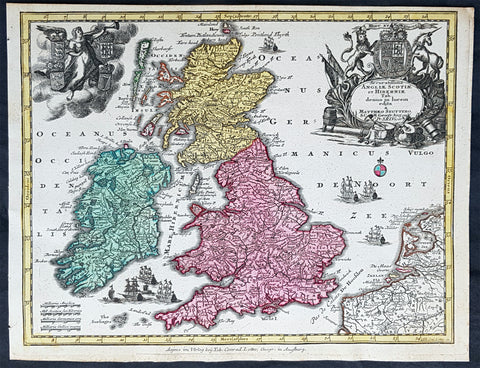
1744 Georg Mattaus Seutter Antique Map of Great Britain & Ireland - Scotland et.
- Title : Accuratissima Angliae, Scotiae ei Hiberniae........a Matth. Seutteri...T C Lotter, Geogr.
- Ref #: 93394
- Size: 11in x 8 1/2in (280mm x 215mm)
- Date : 1744
- Condition: (A+) Fine Condition
Description:
This beautifully hand coloured original copper-plate engraved antique map of Great Britain & Ireland was engraved by Tobias Lotter and was published in the 1744 edition of GM Seutters Atlas Minor Prae cipua Orbis Terrarum Imperia Regna et Provincias...., Augsburg, Germany.
General Definitions:
Paper thickness and quality: - Heavy and stable
Paper color : - off white
Age of map color: - Original
Colors used: - Yellow, green, blue, pink
General color appearance: - Authentic
Paper size: - 11in x 8 1/2in (280mm x 215mm)
Plate size: - 10 1/2in x 8in (265mm x 205mm)
Margins: - Min 1/4in (5mm)
Imperfections:
Margins: - None
Plate area: - None
Verso: - None
Imperfections:
Margins: - Top margin cropped into border
Plate area: - None
Verso: - None
Background:
Atlas Minor was a series of beautiful maps of all parts of the world. Georg Matthäus Seutter was one of the most and important of the German cartographers of the 18th century, being appointed as the Geographer to the Imperial Court. His son, Albrecht Carl, joined Matthäus and eventually inherited the business. The maps from Atlas Minor were drawn by the two Seutters and engraved by Tobias Conrad Lotte. These maps are highly detailed and engraved with a bold hand with equally strong original hand color in the body of the map as was the 18th century German style. The cartouches were left uncolored in order to emphasize the elaborately detailed illustrations for which German maps are especially prized. These are some of the most decorative and interesting maps of the eighteenth century.
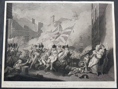
1800 John Singleton Copley Large Antique Print Death of Major Pierson, Jersey
- Title : Death of Major Pierson - The Defeat of the French Troops in the Market Place....Of Saint Heliers in the Island of Jersey Jan 6th 17(81)...Painted by John Singleton Copley....Engraved by A Kessler
- Size: 24in x 18 1/2in (610mm x 480mm)
- Condition: (B) Good Condition
- Date : 1800
- Ref #: 92668
Description:
This large original copper plate engraved antique print of the Death of Major Pierson in the battle of Jersey in 1781, by John Singleton Copley in 1783, was engraved by Albert Kessler in 1800.
General Definitions:
Paper thickness and quality: - Heavy and stable
Paper color : - off white
Age of map color: -
Colors used: -
General color appearance: -
Paper size: - 24in x 18 1/2in (610mm x 480mm)
Plate size: - 24in x 18 1/2in (610mm x 480mm)
Margins: - Min 1/2in (12mm)
Imperfections:
Margins: - L, R & top margins restored using contemporary paper on verso
Plate area: - Two repairs to top of image
Verso: - Repairs as noted
Background:
This painting celebrates the British defence of Jersey against French invasion in 1781 and also pays tribute to a young Major, Francis Peirson, who lost his life in the process. Originally a part of France, the island of Jersey had been in the possession of the English since 1066. On the night of 5-6 January 1781 a small army of French soldiers landed on the island and marched on the capital, St Helier. They captured the Governor, Moses Corbet, and forced him to sign a document of surrender. However, the British garrison and the Jersey militia launched a counter-attack, led by Major Peirson, during the course of which Peirson was killed by a French sniper. Almost immediately, Peirsons black servant, Pompey, turned on the sniper and shot him dead. A battle ensued in Royal Square and the French were defeated.
At a time when defeat in the American colonies was imminent, news of the British victory in Jersey was greeted with alacrity in England. John Boydell, a successful engraver and printseller, immediately commissioned this picture from Copley, who had already made his reputation with The Collapse of the Earl of Chatham in the House of Lords (1779-81)
The theme of the modern noble hero expiring at the scene of battle was established by Benjamin West (1738-1820), who, like Copley, was American by birth. Copley increased the drama of the event by making the moment of Peirsons death coincide with the British victory over the French, rather than earlier in the battle. The picture is full of movement and colour, but is also carefully orchestrated. Peirsons body in the centre of the picture offers a splash of white against the red of the soldiers jackets, and appears to topple forward out of the painting. The group of men who support him, like figures in a Deposition, are crowned by the Union Jack, a symbol of Britains victory. To their left, the black servant, Pompey, has just shot the French sniper in the background. To the right of the picture, a terrified family (modelled on Copleys own wife, family nurse and children), attempt to flee from the scene. Many of the officers in the painting are said to be accurate portraits and Pompey was modelled by the black servant of the auctioneer James Christie. The setting for the picture is also carefully depicted, looking towards Royal Square along what is now Peirson Place, with the statue of George II in the background.
When the picture was first exhibited publicly in May 1784, crowds of people came to see it and, according to one critic, the chorus of praise reached all the way to Buckingham Palace.
Copley, John Singleton 1738 - 1815
Singleton was an Anglo-American painter, active in both colonial America and England. He was probably born in Boston, Massachusetts, to Richard and Mary Singleton Copley, both Anglo-Irish. He is famous for his portrait paintings of wealthy and influential figures in colonial New England, depicting in particular middle-class subjects. His portraits were innovative in their tendency to depict artifacts relating to these individuals lives.
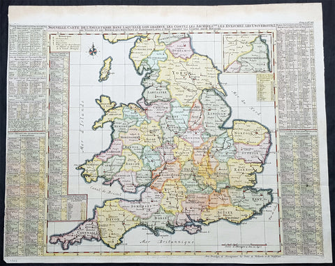
1719 Henri Chatelain Large Antique Map of England & Wales
- Title : Nouvelle Carte de L Angleterre....
- Ref #: 93424
- Size: 25 1/2in x 21in (650mm x 535mm)
- Date : 1719
- Condition: (A) Very Good Condition
Description:
This large beautifully hand coloured original copper plate engraved antique map of England & Wales was published by Henri Abraham Chatelain in 1719, in his famous Atlas Historique.
General Definitions:
Paper thickness and quality: - Heavy and stable
Paper color : - off white
Age of map color: - Early
Colors used: - Yellow, green, blue, pink
General color appearance: - Authentic
Paper size: - 25 1/2in x 21in (650mm x 535mm)
Plate size: - 25in x 19in (635mm x 490mm)
Margins: - Min 1/8in (3mm)
Imperfections:
Margins: - Left margin cropped to plate-mark
Plate area: - Folds as issued
Verso: - Folds as issued